
A place in Clarke · Longmarsh District
Rock Hall Farm
A working farm, two surviving homes, and the lives around them
A stone farmhouse and a log cabin west of Berryville, and the long history of the farm where they stand.
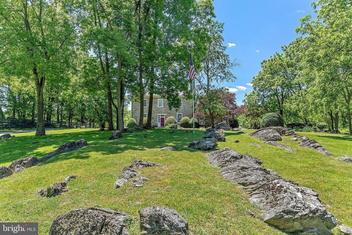
Two homes on Rock Hall Farm Lane, west of Berryville, stand on what was once one larger farm: the stone farmhouse at 420 and a small dwelling of hand-hewn logs at 410. The cabin belongs to the story of that working farm and its later life as a sociable country retreat.
The farm’s own history reaches much further back. A Hardesty family descendant identifies it as the family’s old homestead, and the papers of Richard Hardesty’s estate name people the estate held in slavery: an 1848 inventory lists Warner, Easter, Lewis, John, Sarah, Frances and Charles, and in 1859 a court ordered the estate’s enslaved people sold.
A century later, Neill and Jean Kimball made Rock Hall a working and sociable country home, with ties to friends in the West. Oral history also remembers the farm as a Washington lawyer’s country retreat. The farmhouse and cabin have been separate properties since the early 2000s.
An 1872 sale notice names an overseer’s house on the farm. We believe the surviving log cabin is likely that house, adapted over time and still standing on its original site.
Six dates in the record
- 1848 People An inventory of Richard Hardesty’s estate lists seven people held in slavery: Warner, Easter, Lewis, John, Sarah, Frances and Charles. The Hardesty estate
- 1859 People and ownership A court orders the estate’s land and the people it held in slavery sold at auction. The notice for the land describes a “FINE STONE DWELLING.” The sale and the dispute
- 1872 Building evidence A sale notice for the Hardesty home tract lists a dwelling house and an overseer’s house. The cabin
- 1899 Ownership Charles E. Clevenger buys the 233½-acre farm at a court sale. His deed traces the land back to the Hardesty estate. Changing hands
- 1948 People The Clarke Courier calls Rock Hall Farm the Kimballs’ “home in Clarke.” That March, visitors land a Piper Cub in a field at the farm. The Kimballs at home
- 1987 Building evidence The farm survey, dated 1987 and revised and recorded in 1994, depicts a small building at the present cabin site, with the legible labels “2 story” and “log.” The cabin
These dates trace the people, ownership and surviving buildings of Rock Hall.
The place today
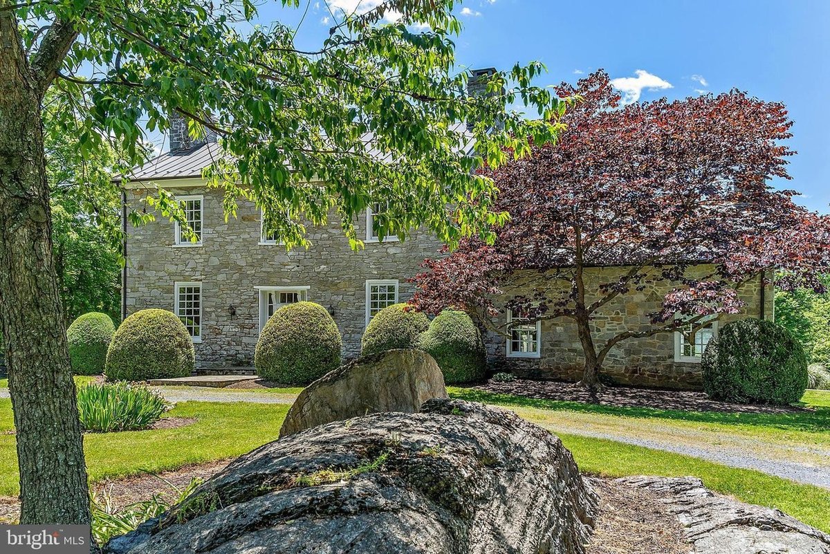
The farmhouse at 420 is a stone house with a lower stone wing. The county’s assessment record gives 1840 as its year built. When the state surveyed Clarke County’s older rural buildings in 1987–1989, it listed the house as Rock Hall Farm, one of the county’s vernacular stone buildings.
The log cabin at 410 stands north of the farmhouse, at the end of its own drive. Each building now has its own lot, and present parcel lines are not the boundary of the historic farm. The chapters below follow the larger farm and the people who lived and worked there.
The Hardesty estate and the people it held in slavery
When William Mason Hardesty died in 1935, the Clarke Courier recorded that he had been born in 1858 at “Rock Hall,” the old Hardesty homestead, the son of Charles W. and Lucretia Hardesty. He spent his whole life in Clarke, farming until 1917, and the paper counted him among the county’s finest grain and stock raisers.
A Hardesty family descendant identifies that homestead as this farm. In 1939 the county historical society’s tentative list of Longmarsh homes and buildings from before 1860 also entered “Rock Hall—Hardestys,” though it did not say where that Rock Hall stood.
Most of what is known about the Hardesty land before the Civil War comes from the court papers of Richard Hardesty’s estate. Richard made his will in October 1843 and had died by early 1848. He left his estate to his wife, Sarah Ann, for her life or widowhood, and then in equal shares to “the Eleven Children now living by my said wife Sarah Ann,” with their son William G. Hardesty as executor.
Clarke County was a plantation society, in which enslaved labor was central to agriculture, and Richard Hardesty’s estate held people in slavery. The inventory taken in March 1848, as abstracted by Patricia B. Duncan, lists “slaves Warner, woman Easter & child Lewis, boy John, girl Sarah, girl Frances, man Charles 20 old & now sick” among the farm and household property. The will directed that if Sarah Ann remarried, “her Dower be laid off in my land & negroes.”
By 1859 Sarah Ann had died, and two of the sons, Richard S. and Thomas P. Hardesty, went to the Circuit Court to have the estate sold and divided: the land, including a leasehold, and the people it held in slavery. The other heirs answered that neither the land nor the people could be conveniently divided, and joined in asking “to have a sale of both, & a division of the proceeds of Sale.”
On May 13, 1859, the court ordered the land sold at auction, with William as the court’s commissioner for the sale. Finding that “an Equal division in Kind of the slaves of the Estate cannot be made,” it also ordered him to sell the people at public auction, on six months’ credit, “as soon as the said Slaves can be got in possession.”
Sources for this section
- Clarke Courier, October 17, 1935, page 7
- Clarke Courier, June 22, 1939, page 1
- Patricia B. Duncan, Clarke County, Virginia Will Book Abstracts: the 1848 inventory [B:236]
- Library of Virginia, Clarke County chancery cause 043-1886-025, Hardesty v. Hardesty
- Kalbian, Clarke County survey, 1992, drawing on Hofstra
The people sold and the land in dispute, 1859–1868
That October William, as the court’s commissioner, advertised the land in the Winchester Republican. It lay “one mile East of the Spout Spring and bordering on the Berryville Turnpike,” and adjoined the lands of Mrs. Elizabeth K. Carter. The notice set out two tracts: 261½ acres with a “FINE STONE DWELLING,” a barn, stabling and an orchard, and 270 or 280 acres with “a TOLERABLE DWELLING,” with about seventy acres of leased land adjoining both. The auction was set for November 10, 1859. “My brothers, Adrian D. and C. W. Hardesty, residing on the farm,” William wrote, “will show the land to any one wishing to see it.”
Two later filings say the people were sold. In September 1865 Adrian swore that William had “sold the slaves & other personalty, and made report of the sale, it is believed in 1860 or 1861,” and the heirs’ bill of 1866 says that he “made sale of all the slaves of said decedents Estate.”
The surviving papers do not say who was sold. They name no buyer, and the report of the sale has not been found; in 1865 Adrian described the court’s papers as “in great confusion.” Nothing shows whether those sold were the people named in 1848, where they were living when the court ordered the sale, or what became of them.
Meanwhile the estate rented its land to tenants, among them John P. and Peter McMurray and John Ritter in 1860. According to two of the heirs, the lawsuit then stalled: “nothing further was done during the War.” Adrian later testified that he took seventy bushels of wheat in 1863.
After the war two of the brothers were on opposite sides in court. In 1865 Adrian obtained an injunction to stop William from selling the land privately, outside the court’s 1859 order. In September 1866 Adrian and C. W. Hardesty, now “Agents for the heirs of Richard Hardesty,” offered it again in the Winchester Times: a two-hundred-acre tract whose dwelling was “a fine Stone Building, containing nine rooms,” and an adjoining tract of about 270 acres with a tenant house. None of these notices names Rock Hall.
Changing hands, 1868–1933
The outcome of the 1859 auction remains unresolved, but the later passage of the Hardesty home tract is clearer. On April 7, 1868, the Hardesty heirs conveyed it to S. J. C. Moore as trustee for Hannah C. Page. Moore sold it to John W. Stewart on June 12, 1872. Stewart’s will gave his son Robert a life interest, with the land to pass to the children of Stewart’s daughters in the Strong and Boyd families if Robert died without surviving issue. Robert died in 1879 without children.
Through these changes of ownership, people continued to rent and work the farm. In January 1896 J. W. Carlisle testified that he had rented and cultivated it, “I think in 1893.” A neighbor, Rutherford, remembered helping “Mr Payne, who lived there” to thresh. When the later sale was confirmed, Walter Brotherton retained the right to cut, thresh and remove the growing grain. The records do not say which buildings any of these men occupied.
The Stewart interests eventually passed through a court sale to Charles E. Clevenger. The court accepted his private bid of $26.50 an acre for the enlarged, 233½-acre tract. His deed, dated February 7, 1899, and recorded April 1, traces the land back through the Stewarts and the Page trust to the Hardesty estate, and describes the buildings only as “all its buildings and appurtenances.”
No deed read so far shows how the farm passed from Charles E. Clevenger to the Kimballs.
Sources for this section
- Clarke Courier, June 6, 1872, page 3
- Library of Virginia, Clarke County chancery cause 043-1879-002
- Clarke Deed Book Y, pages 458–459, Clevenger conveyance, FamilySearch
- Clarke Deed Book Y, page 460, recording certificate, FamilySearch
- Library of Virginia, Clarke County chancery cause 043-1899-011, Boyd and Strong proceedings
The Clevenger farm, 1932–1933
The Clevenger farm in these newspaper notices was probably this Rock Hall. The Courier called it “Rock Hall” in 1933, and described Miss Bertha Clevenger’s farm the year before as bordering the Berryville and Winchester Turnpike about four miles west of Berryville, a location consistent with the Kimballs’ later home.
In February 1932 a trustee advertised a sale of C. Roy Fishpaw’s horses and farm implements “on the farm of Miss Bertha Clevenger.” A March notice reported that Fishpaw had moved to his father’s farm near Crums Church and that, at last report, the Clevenger farm “had not been rented.”
By early January 1933, the paper placed newlyweds Floyd Hardesty and Vada Irene Clemons at their home on the Clevenger farm. His parents, Mr. and Mrs. H. J. Hardesty, gave them a shower after their marriage at Westminster, Maryland. About seventy-five guests attended. Gifts arrived in a large well decorated in green and white paper and “filled to the top.” At a late hour the guests left, wishing the couple “much success at ‘Rock Hall’, the Clevenger farm.”
An October 1933 notice recorded a family visit to Floyd and Vada’s home at Purcellville. The notices do not tell us when they moved or on what terms they lived at the Clevenger farm. Nor has a connection been established between Floyd’s family and the earlier Hardesty estate.
The Kimballs at home
Rock Hall comes clearly into view again after the Second World War, as the home of Neill W. Kimball and his wife, Jean, both from Colorado. When the census taker came in April 1950 the household numbered five: Neill and Jean, both fifty-five; Neill’s widowed father, George M. Kimball, eighty-four; and Neill’s sister, Leslie, with her husband, Glen Sunderlin, who taught mathematics at the county high school. The census listed Neill’s occupation as farmer.
Kimball came from a Colorado newspaper family: his grandfather George West had founded the Golden Transcript in 1866. The Courier later described him as a third-generation newspaperman who left journalism school for the Army in 1917, reported the war in Africa and Europe, served as adjutant general of Colorado and directed public relations for the Veterans of Foreign Wars. In 1948, while he held that post in Washington, the Courier recorded him coming out to spend the weekend with Mrs. Kimball at Rock Hall Farm, “their home in Clarke.”
The Courier’s small notices show the farm at work and the family in the community. In March 1948 its classified column offered a nine-month-old purebred boar for sale at Rock Hall Farm. That December Leslie Sunderlin, an assistant troop leader, welcomed thirteen new Girl Scouts at Berryville’s Community Building, and the paper listed Mrs. Kimball’s home as one of four places where Home Demonstration Club members could learn to make Christmas door decorations. In February 1958, back from a winter in New Mexico, the Kimballs reopened Rock Hall, “their home west of Berryville on the Winchester Pike.”
In July 1958, apparently writing from Rock Hall, Jean and Neill told old friends it was “nice country in which to live.” On the first three evenings of summer they had built fires in the library fireplace. They had “an excellent herdsman with 14 years of dairy experience,” and Leslie and Glen were “only four miles away.”
Country life had not replaced their Western friendships. “We both miss our old and dear friends in the West,” they wrote, closing with an invitation: “We are so anxious to have visitors.”
By 1961 a young man, James “Jimmy” Hunt, had made his home with the Kimballs for several years; he attended the Clarke schools and joined the Navy at eighteen. In December 1962 he spent his first leave since duty on the Cuban blockade at Rock Hall Farm. The next July the Kimballs and Sunderlins hosted a Fourth of July picnic at the farm.
Sources for this section
- 1950 U.S. Census, Clarke County, Virginia, Long Marsh district, enumeration district 22-9, sheet 10
- “Golden Transcript hits 155th anniversary,” Colorado Community Media, 2021
- Golden History Museum & Park: George and Eliza West with three grandchildren, c. 1905
- Clarke Courier, March 18, 1948, page 9
- Clarke Courier, March 25, 1948, page 6
- Clarke Courier, March 25, 1948, page 17
- Clarke Courier, December 16, 1948, page 9
- Clarke Courier, December 2, 1948, page 1
- Clarke Courier, February 27, 1958
- Jean and Neil Kimball to the Goetzes, July 17, 1958; Golden History Museum & Park, FIC2025.32
- Joining the Navy: Clarke Courier, October 5, 1961, page 10
- Home on leave: Clarke Courier, December 6, 1962, page 3
- Clarke Courier, July 11, 1963, page 3
- Clarke Courier, May 23, 1963, page 1

Arriving by Piper Cub
Some visitors arrived by air. One Saturday in March 1948 Mr. and Mrs. James Sunderlin of Clinton, Maryland, flew in to visit Glen and Leslie Sunderlin, making the trip by Piper Cub and landing in a field at Rock Hall Farm.
The same week the paper noted a visit from Col. Nelson Holderman, a Congressional Medal of Honor holder then commandant of the California Veterans Home and a cousin of both Leslie and Neill. In May, Mr. and Mrs. H. Fleet Parsons of Golden, Colorado, editors and publishers of the Transcript, came to see their relatives, the Kimballs and Sunderlins.
Sources for this section
Painters, a poet and historians
Both Kimballs painted. Jean Kimball chaired the Fine Arts Department of the county’s Woman’s Club, and at the club’s exhibit in March 1962 she won a blue ribbon for an oil painting. At its arts and crafts show the next March she took red ribbons in the landscape and animal-painting classes, and the General won a red ribbon for a still life.
Among the Kimballs’ most frequent recorded guests were LeRoy and Anne Hafen, historians of the American West. The Courier first noted them at Rock Hall in the summer of 1948, just back from a year in Scotland, where Dr. Hafen had been an exchange professor at the University of Glasgow. In all, the notices found record one or both of them as the Kimballs’ guests six times between 1948 and 1962, first from Denver and later from Provo, Utah, where he headed the history department at Brigham Young University.
Anne Hafen came in her own right. In January 1950 the Courier introduced her as “Dr. Anne Hafen, Director of Research Division of the Colorado Historical Society,” spending a weekend at Rock Hall with her son Karl and his family while she did research in Washington and Virginia “for her book on Meriweather Lewis.” By 1962 the paper called her “a nationally known poet” who had attended the recent Poetry Festival in Washington.
Sources for this section
- Clarke Courier, March 22, 1962, page 5
- Clarke Courier, March 21, 1963, page 5
- Clarke Courier, July 8, 1948, page 3
- Clarke Courier, January 19, 1950, page 3
- Clarke Courier, September 8, 1955, page 10
- Clarke Courier, January 10, 1957, page 10
- Clarke Courier, November 3, 1960, page 6
- Clarke Courier, November 8, 1962, page 3
Memorial Day, 1963
“The one sure way to honor the dead is by helping the living—not only veterans of past wars, but National Guardsmen and other servicemen and women who stand ready and alert.”
On Sunday, May 26, 1963, General Kimball gave the address at the county’s Memorial Day exercises at Green Hill Cemetery, and the Courier’s report the following week quoted his words. In announcing the address, the paper said that since retiring to Rock Hall he had been very active in community, veterans’ and church organizations.
The log cabin
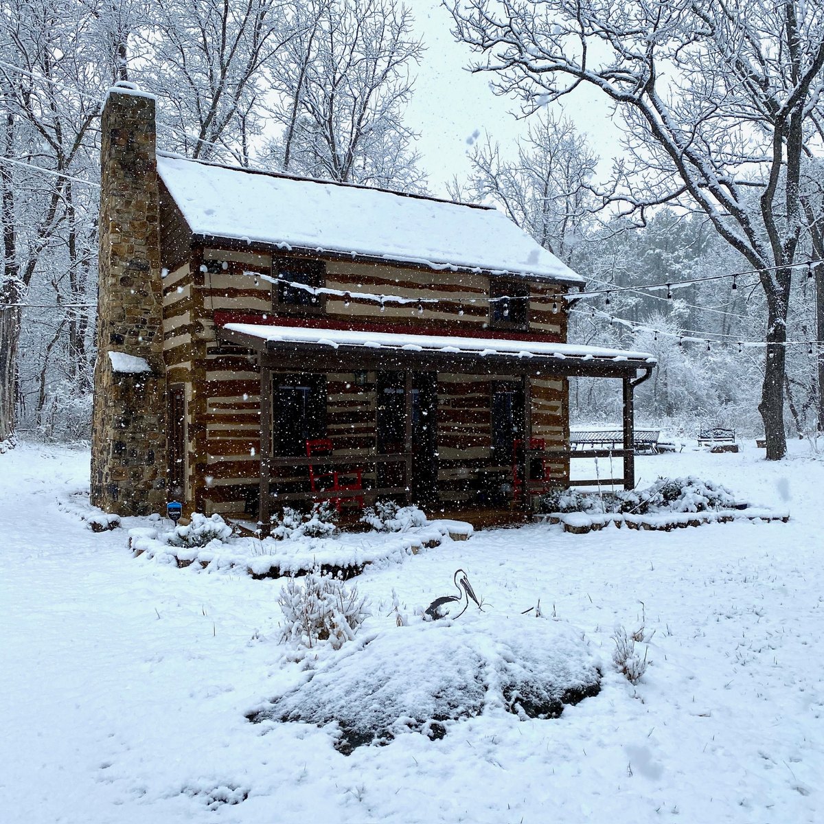
The small, story-and-a-half cabin north of the farmhouse is built of hand-hewn logs and is believed to date to the mid-1800s. In 1872, a sale notice for the farm listed “a Comfortable Dwelling House, an overseer’s house and other improvements.” We believe the present cabin is likely that second dwelling, still on its original site and adapted over the years.
A map based on a 1937–38 survey places a secondary building near where the cabin stands today. An approach track is visible in a 1958 aerial, and photographs from 1972 and 1977 appear to show the cabin at the end of its driveway. Together with the later maps, the farm survey and the standing log building, these records support a long history at this location.
The farm survey, dated 1987 and revised and recorded in 1994, depicts a small building at the cabin’s location with the legible labels “2 story” and “log.” By late 1995, Joseph and Florelle Madison were planning to renovate the “existing cabin” with a living room, study, kitchen and bathroom; county records also document subsequent sewage and well work.
Prior owners and neighbors remembered the cabin as an artist’s or writer’s retreat. That remembered use adds another chapter to the larger farm’s documented life of painting, writing and visiting friends.
Sources for this section
- Clarke Courier, June 6, 1872, page 3: sale of the home tract
- USGS historical topographic maps and historical aerial photographs, compared during the research; see source note
- USGS EarthExplorer, Aerial Photo Single Frames: 1VCZM00050005 (1972) and 1VEHO00010066 (1977); see source note
- Survey dated December 18, 1987; revised August 1, 1994; recorded August 22, 1994, Clarke County Deed Book 246, page 348
- Account of prior owners and neighbors, as reported to the present owner
- Clarke County environmental health file: proposed renovation and sewage and well records, 1995–1996
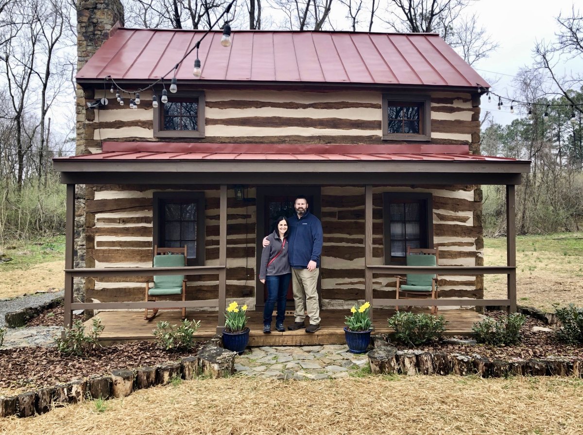
- Photographs of the cabin in January 2020 and of Michael Oak and Jennifer Riley: supplied by Michael Oak and published with his permission
Later owners, and a farm divided
The Kimballs began dividing the farm themselves. In 1952 they sold two small lots whose survey ran “through the Kimball Farm,” south of Route 7 about four miles west of Berryville, and in June 1962 the Courier reported that they had filed an approved map for Rock Hall Subdivision, forty-one half-acre lots facing Route 635; the lots appear to be the strip along Moose Road, next to the present farm. Later divisions followed, and Rock Hall Farm Lane and Stonebrier Lane now reach several private properties.
The Kimballs still held the farm in the 1960s: a November 1963 survey of a three-acre lot they sold on Route 7 marks their “other land” on two sides. County records point to the next owners. A 1974 survey of a neighboring farm names Alltran, Inc. as the adjoining owner under a deed in Deed Book 97, page 119, which county staff notes describe as Jean E. Kimball’s 1972 conveyance to Alltran. The same notes and a later survey of the farm indicate that Alltran sold in 1988 to owners who kept it until 1994. In 1987 the county’s records gave the owner as Alltran, Inc., with Frank B. Hand Jr. named as its agent.
Hand’s connections with Washington and Berryville make him a plausible candidate for the lawyer in the recollection of the farm as a country retreat, though no record makes that identification explicit. He was very likely the Frank B. Hand Jr. who in 1965 gave two Norman Rockwell paintings to Washington institutions: “Norton Wins,” now in the National Gallery of Art, and an unfinished study, “Seated Man in Interior,” to George Washington University, where he had studied law.
By 1995 Joseph and Florelle Madison owned the farm and were planning to renovate the existing cabin. The Madisons sold in 1999. In the early 2000s the land was divided into separate lots, and each building was then sold on its own, the farmhouse in 2004 and the cabin in 2005. The two have been separate properties since.
Sources for this section
- Oral history of the farm as a Washington lawyer’s country retreat
- Clarke County Deed Book 42, pages 263 and 265
- Clarke County Deed Book 69, page 116 (1963 survey) and Deed Book 105, page 285 (1974 survey); county staff notes on the later conveyances
- Clarke Courier, June 21, 1962, page 13
- Clarke County parcel mapping
- Clarke County environmental health file, 1987 application
- Federal Register, December 12, 1978
- National Gallery of Art: Norman Rockwell, Norton Wins, 1916 (2015.19.102)
- Matthew Stoss, “The Other 90 Percent,” GW Magazine, Spring 2016
- Clarke County real estate record, 420 Rock Hall Farm Lane (1999 and 2004 sales)
- Clarke County subdivision approval, 2003; Deed Book 380, page 139
- Clarke County real estate record, 410 Rock Hall Farm Lane (2005 sale)
Cabin photographs
Every photograph of the log cabin in Michael Oak’s collection is shown here: photographs from the real-estate listings of July 2015 and March 2019, and his own photographs from 2019 to 2023. They show the cabin as it has looked in recent years; they are not evidence of its age. Select a photograph to open it at full size.
The snow and porch photographs are with the cabin’s story above
How the cabin is put together
Nine close-ups of the log walls, corners, floor and interior framing supplied by Michael Oak; when they were taken is not recorded. They show flattened log faces crossed by rows of short cuts, log ends stacked at the corners with their upper edges cut to fit the log above, growth rings and cracks in the end grain, chinking between the logs, and, inside, wide floorboards and sawn boards and timbers beside the logs. The National Park Service describes log faces being scored with an axe and then hewn flat with a broad axe; the cuts here look like that scoring. The shaped log ends are consistent with the “V” or steeple notch it describes, but the Park Service cautions against drawing conclusions from notching alone, and these views do not settle it. The contrasting surfaces do not by themselves show which pieces are original, reused or replaced. The photographs cannot show what wood the logs are, how old the trees were or when they were cut; that would take expert examination or tree-ring sampling.
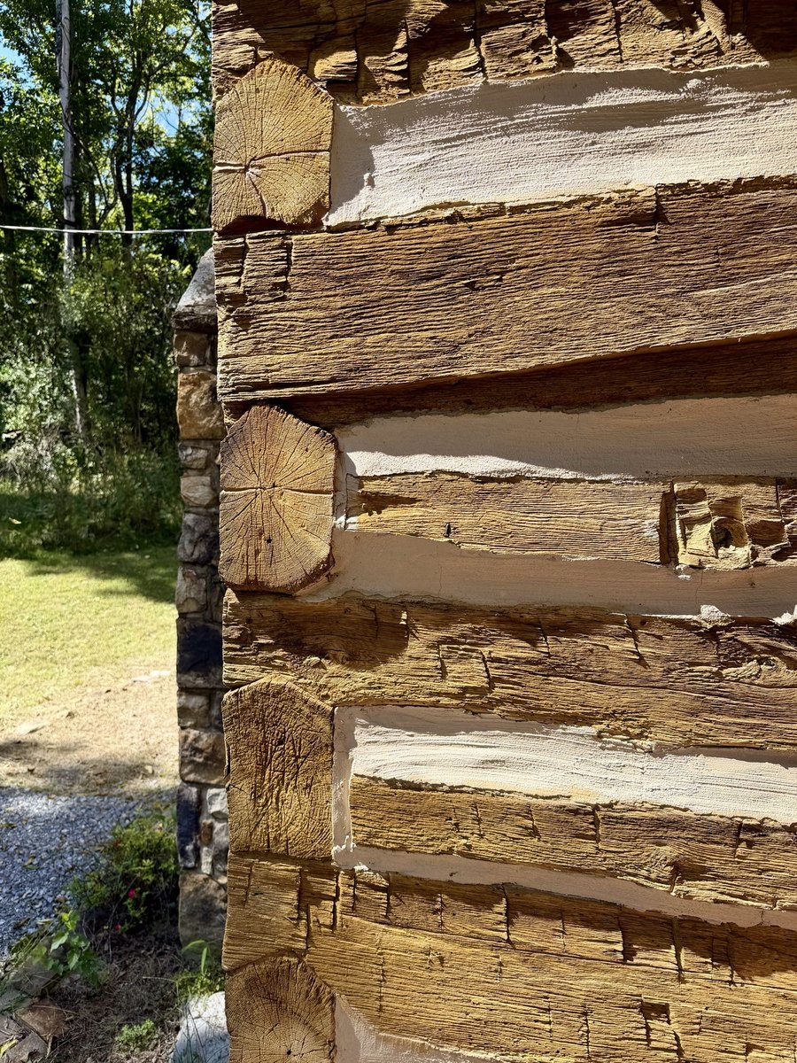
A corner of the cabin: log ends stacked at the corner, flattened log faces and pale chinking between the logs. Date not recorded. Photo courtesy of Michael Oak. 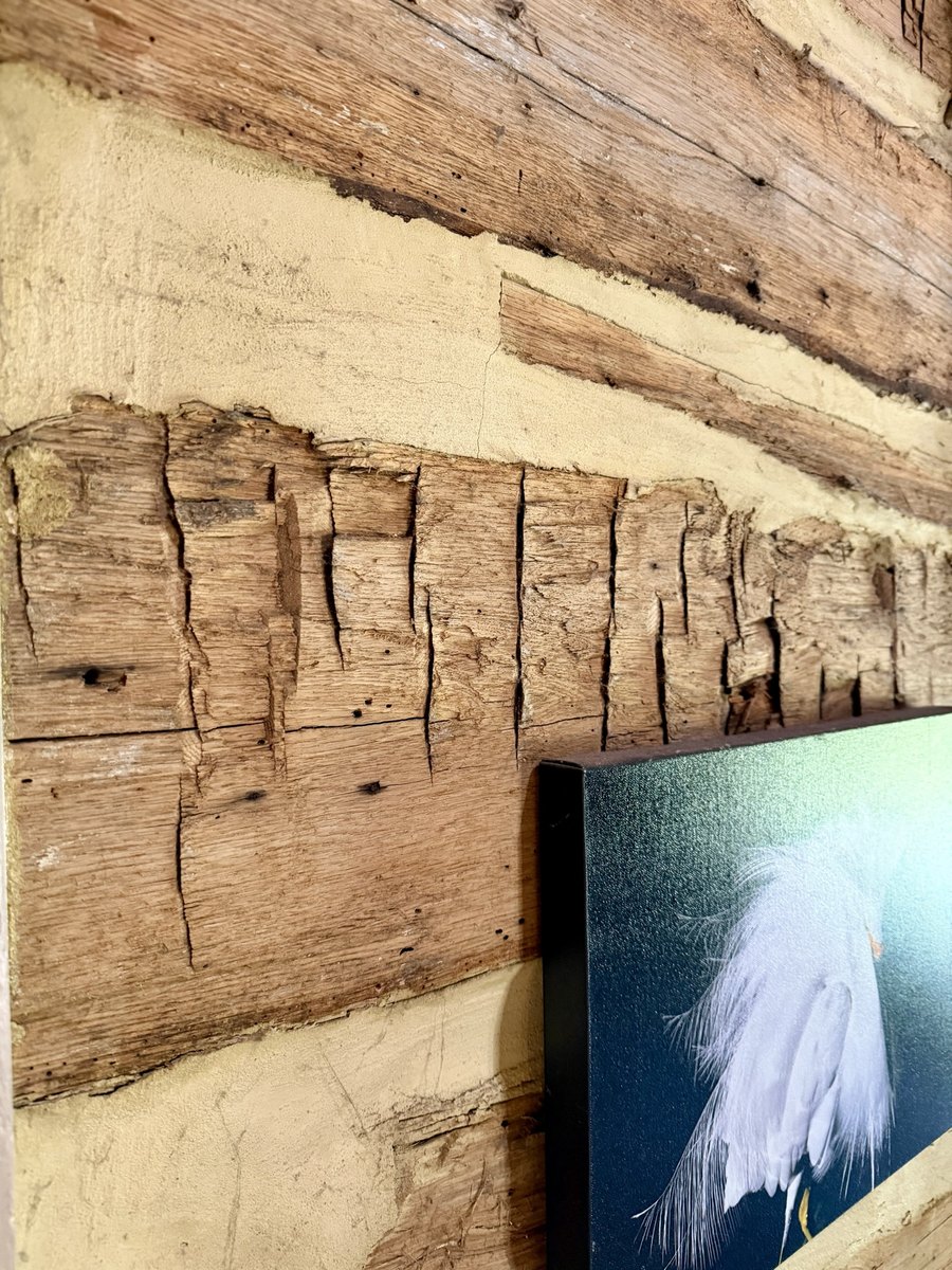
Rows of short cuts across a flattened log face, apparently scoring left when the log was hewn. Date not recorded. Photo courtesy of Michael Oak. 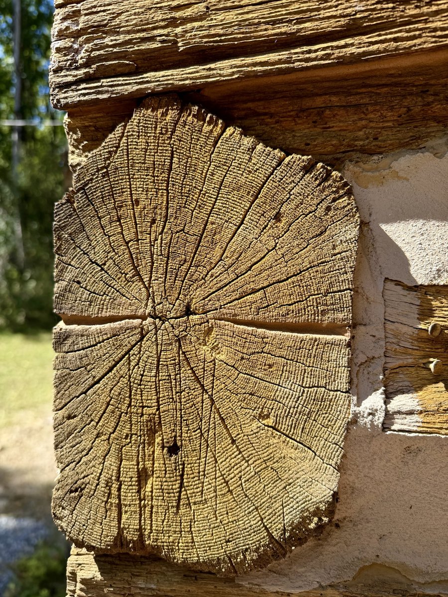
A log end with its upper edge cut to a peak where the log above rests, showing growth rings and seasoning cracks. Date not recorded. Photo courtesy of Michael Oak. 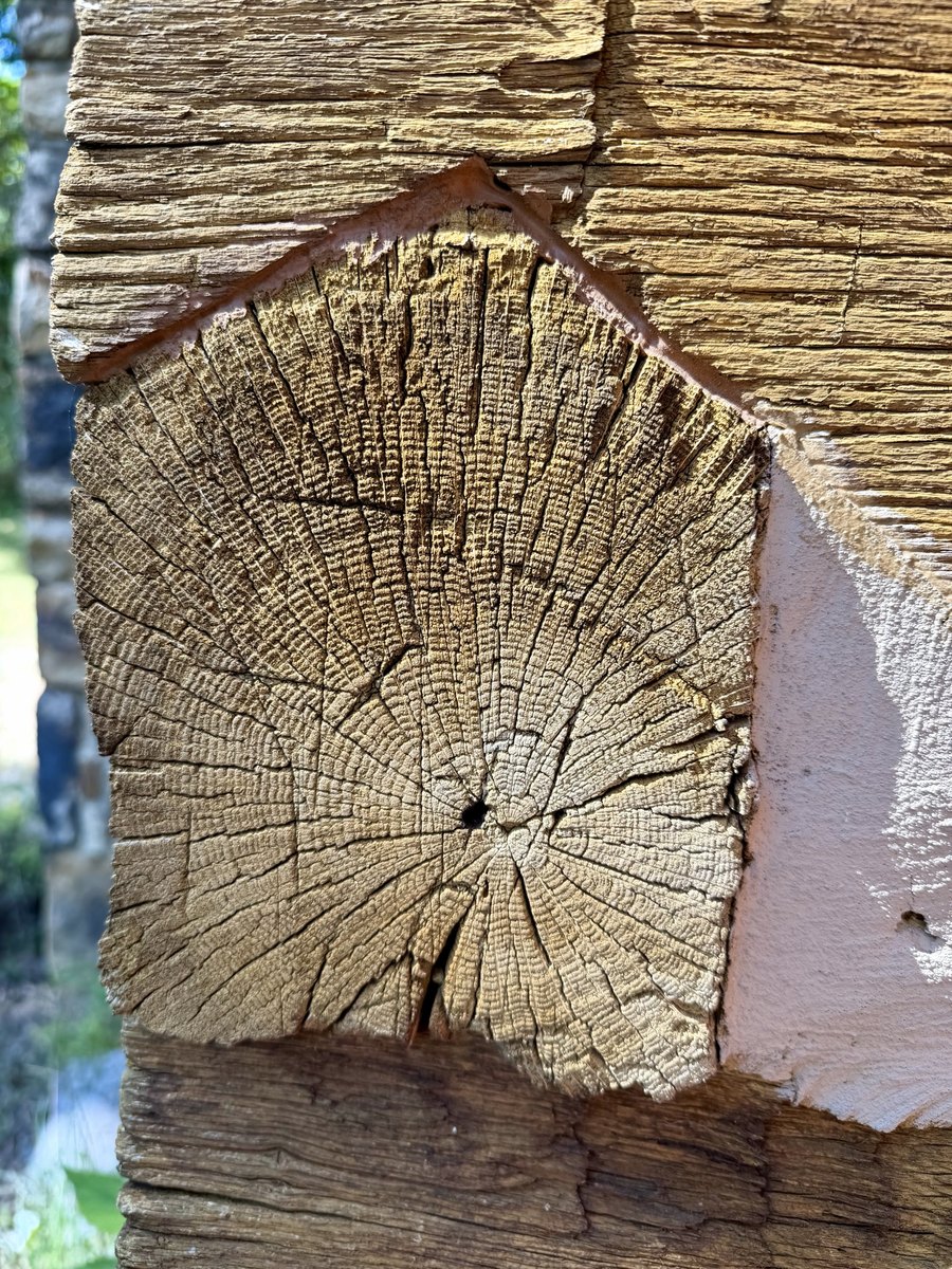
A squared log end with a straight groove cut across it, growth rings and radial cracks. Date not recorded. Photo courtesy of Michael Oak. 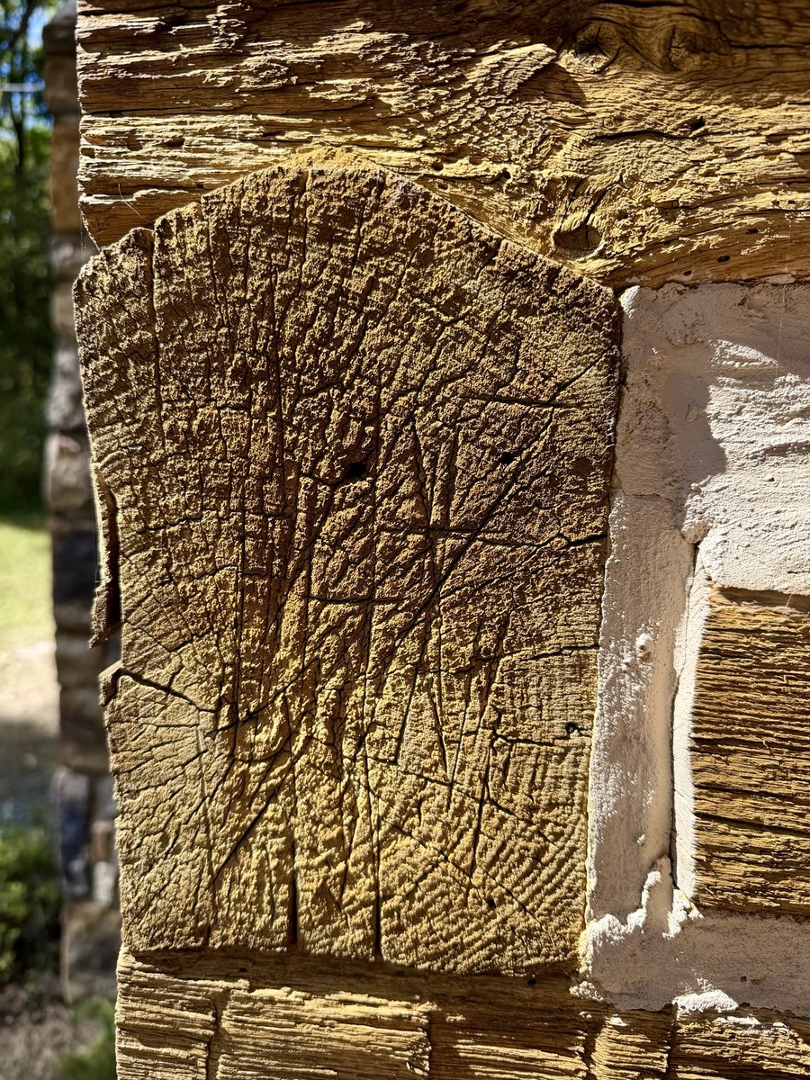
A log end with a shaped upper edge and crossing cut marks on its end grain. Date not recorded. Photo courtesy of Michael Oak. 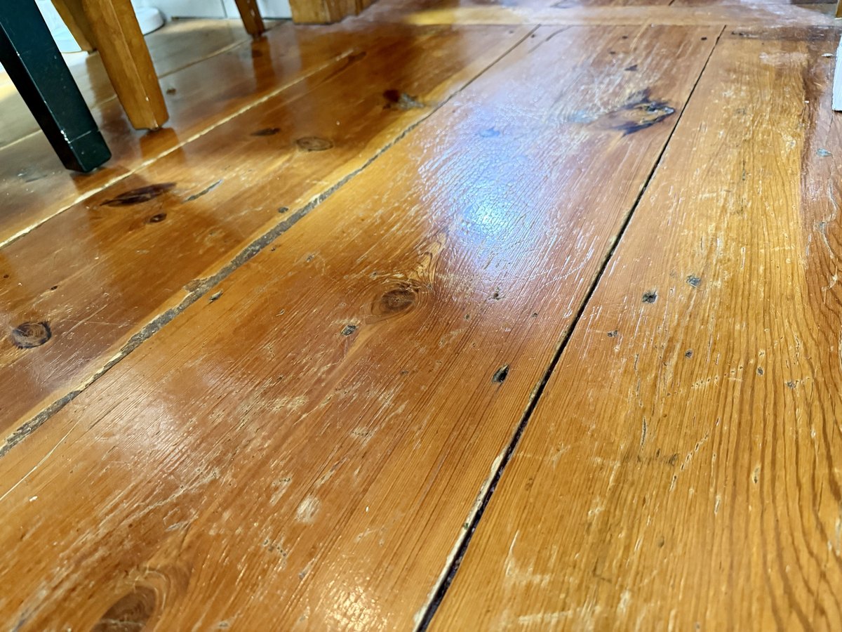
Wide floorboards with knots, narrow gaps between boards and small dark marks that may be fastener heads or holes. Date not recorded. Photo courtesy of Michael Oak. 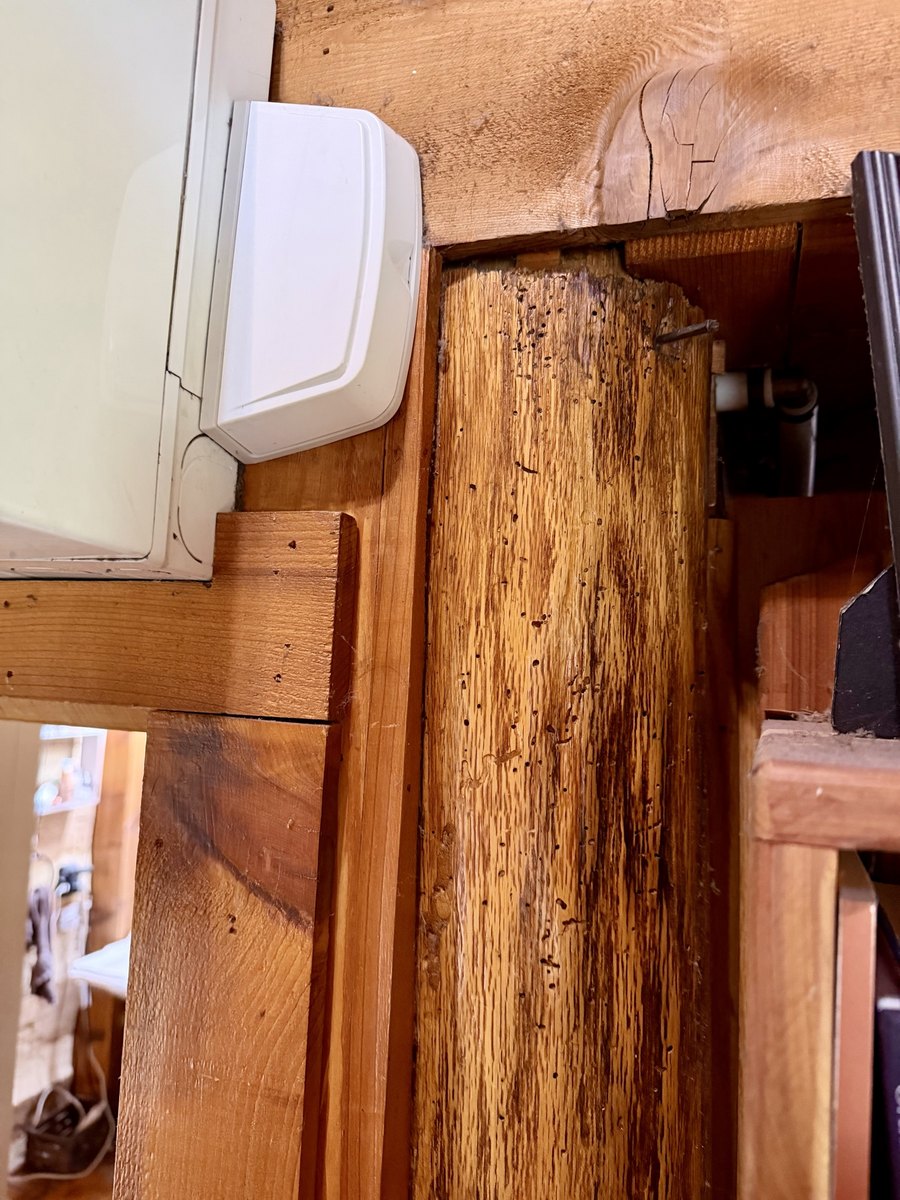
A rounded upright timber pocked with small holes beside an opening, framed by sawn boards under a log. Date not recorded. Photo courtesy of Michael Oak. 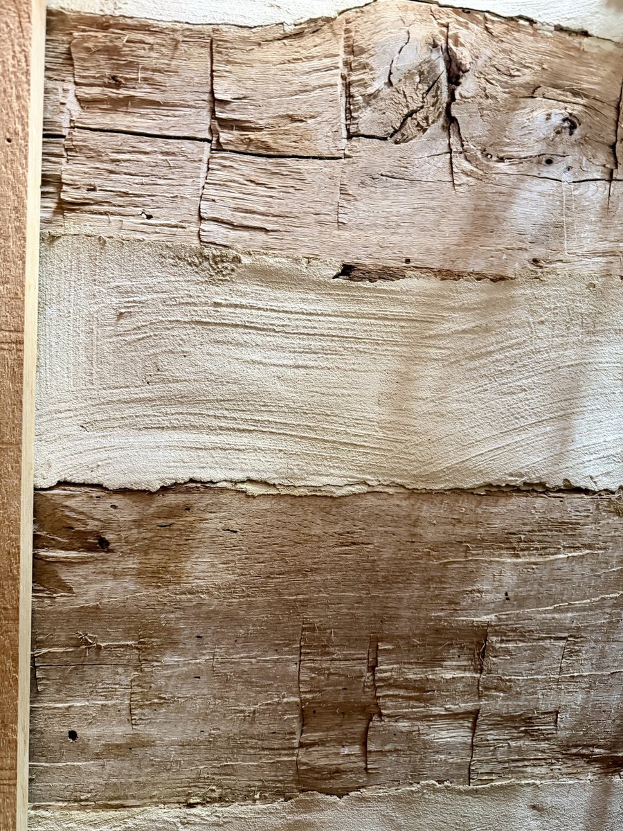
Two log faces with rows of short cuts, and a band of trowelled infill between them. Date not recorded. Photo courtesy of Michael Oak. 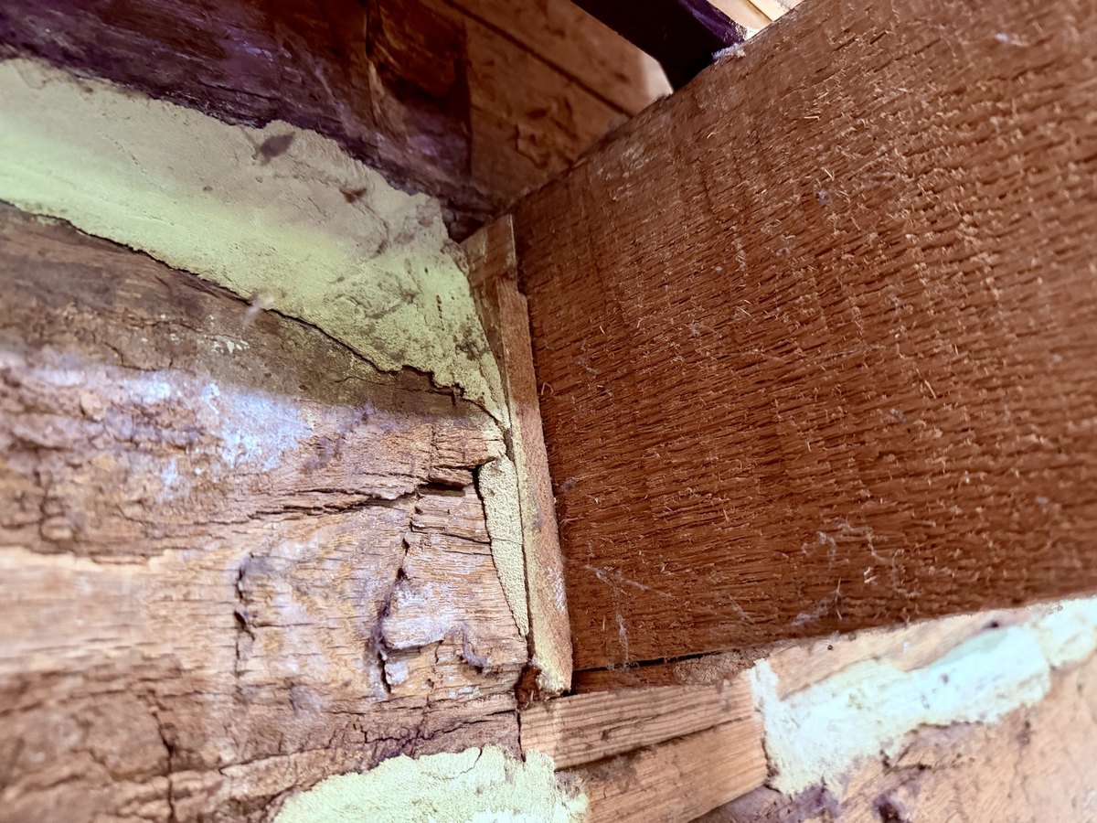
Where a sawn beam meets the log wall, with infill around the logs. Date not recorded. Photo courtesy of Michael Oak.
The July 2015 listing
From the listing that went live on July 8, 2015. The photographs’ own dates are not recorded.
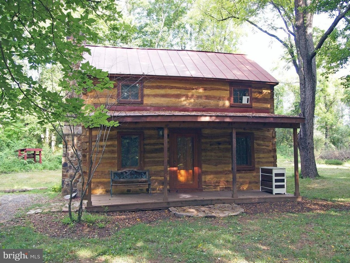
The front of the cabin and its porch. From the listing first posted in July 2015; photograph date unknown. Image via Redfin / Bright MLS. 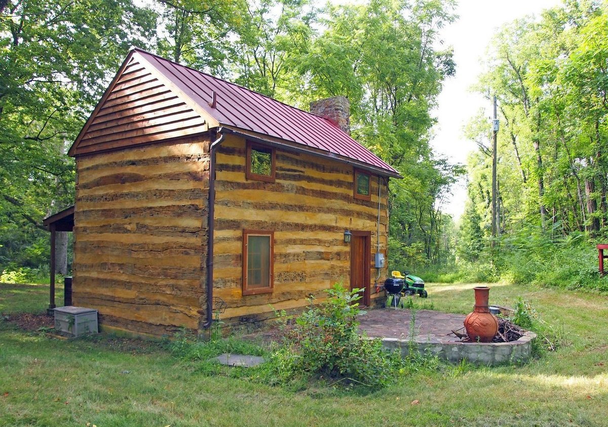
The back of the cabin and its patio. From the July 2015 listing; photograph date unknown. Image via Redfin / Bright MLS. 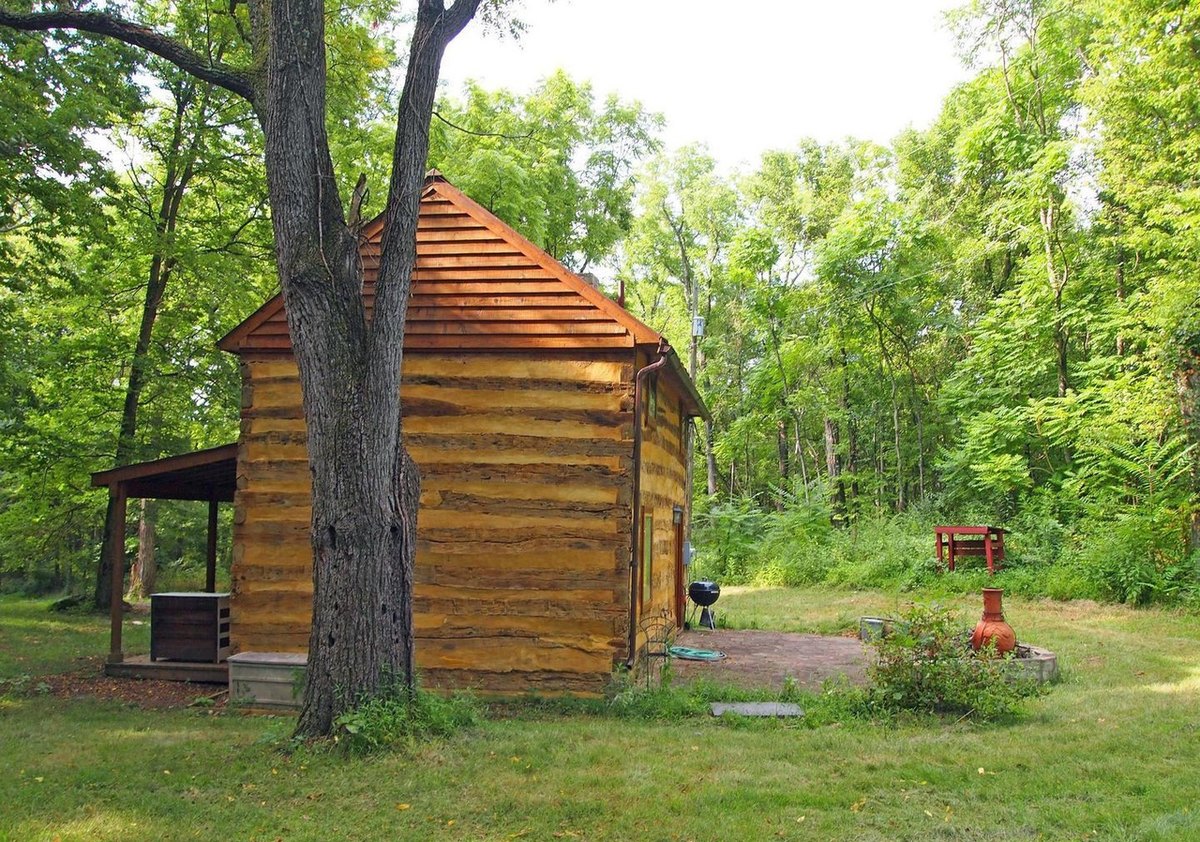
The back corner, behind a large tree. From the July 2015 listing; photograph date unknown. Image via Redfin / Bright MLS. 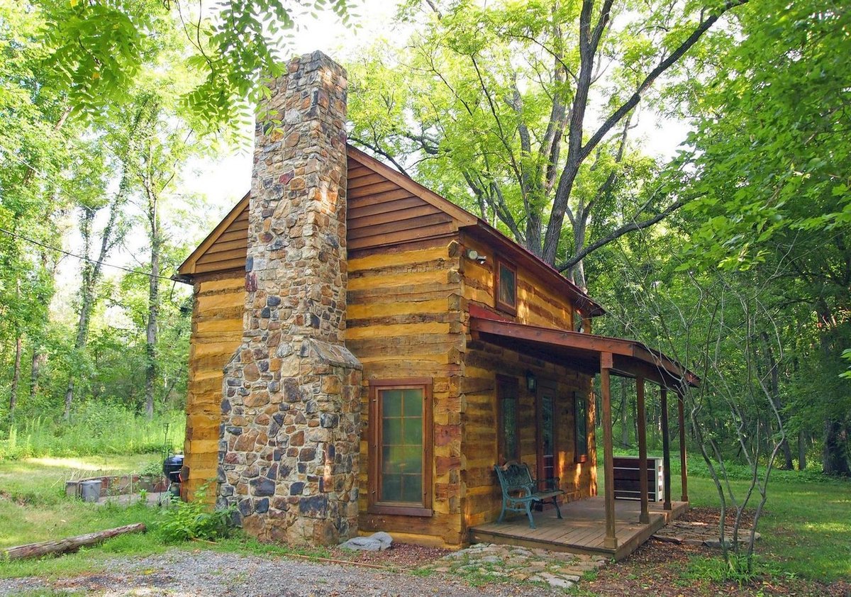
The chimney end in summer. From the July 2015 listing; photograph date unknown. Image via Redfin / Bright MLS. 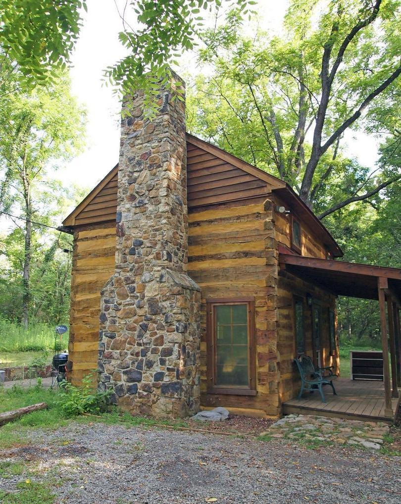
The chimney end, closer. From the July 2015 listing; photograph date unknown. Image via Redfin / Bright MLS. 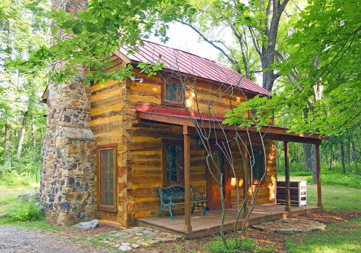
The chimney end and front porch. From the July 2015 listing; photograph date unknown. Image via Redfin / Bright MLS. 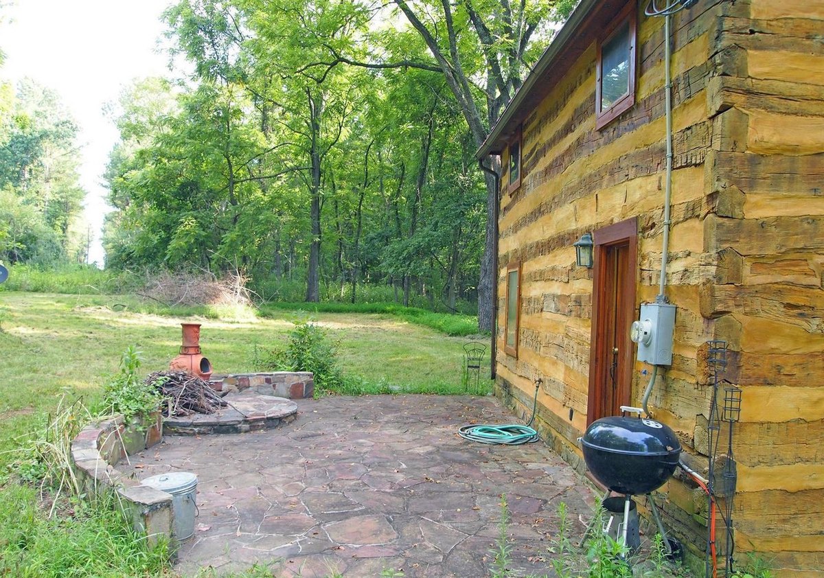
The back patio beside the cabin wall. From the July 2015 listing; photograph date unknown. Image via Redfin / Bright MLS. 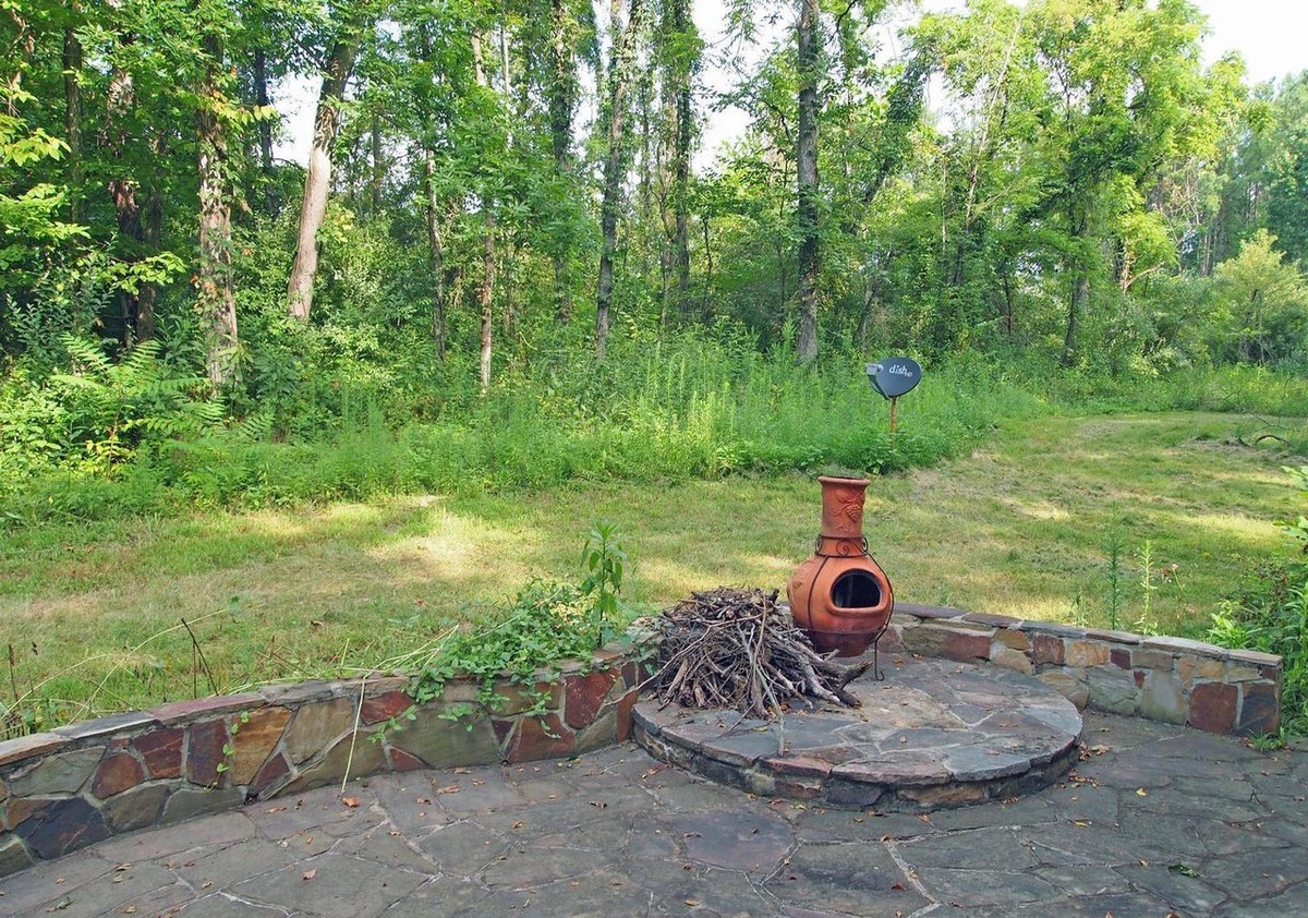
The patio's curved stone wall and fire pit. From the July 2015 listing; photograph date unknown. Image via Redfin / Bright MLS. 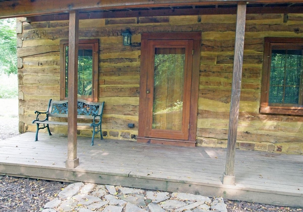
The front door and porch bench. From the July 2015 listing; photograph date unknown. Image via Redfin / Bright MLS. 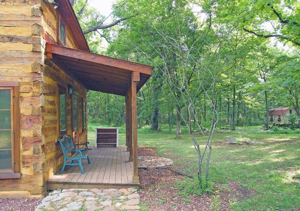
The front porch from its end. From the July 2015 listing; photograph date unknown. Image via Redfin / Bright MLS. 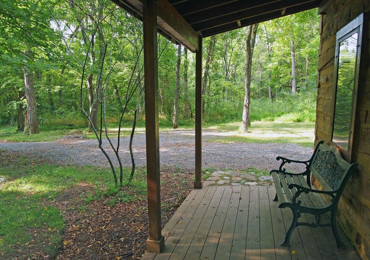
Looking out from the porch to the drive. From the July 2015 listing; photograph date unknown. Image via Redfin / Bright MLS. 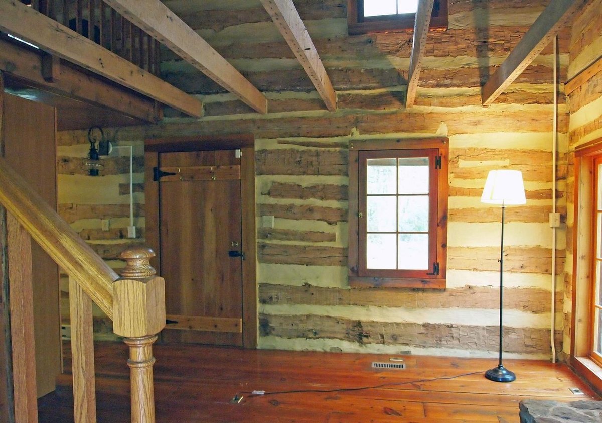
The main room, toward the front door. From the July 2015 listing; photograph date unknown. Image via Redfin / Bright MLS. 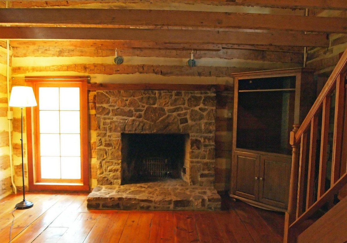
The open stone fireplace. From the July 2015 listing; photograph date unknown. Image via Redfin / Bright MLS. 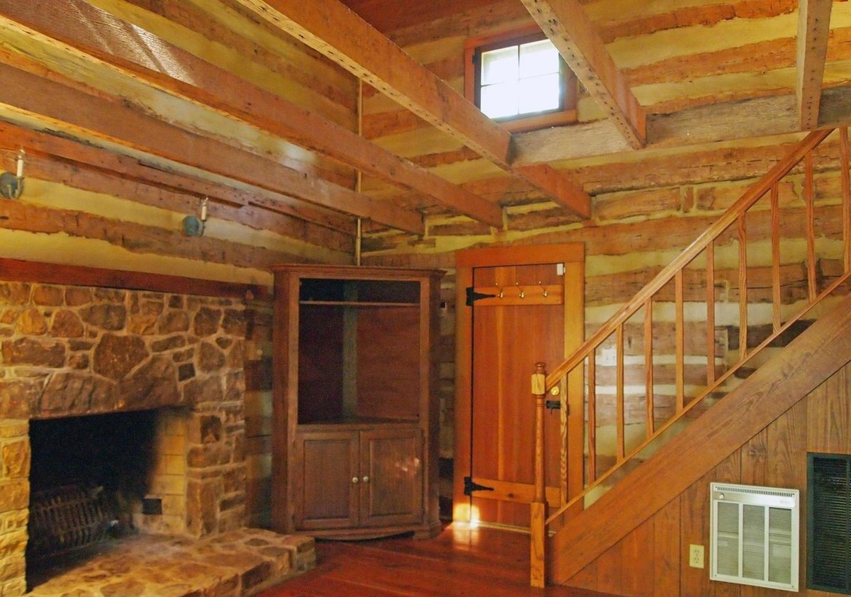
The fireplace, cabinet and stair. From the July 2015 listing; photograph date unknown. Image via Redfin / Bright MLS. 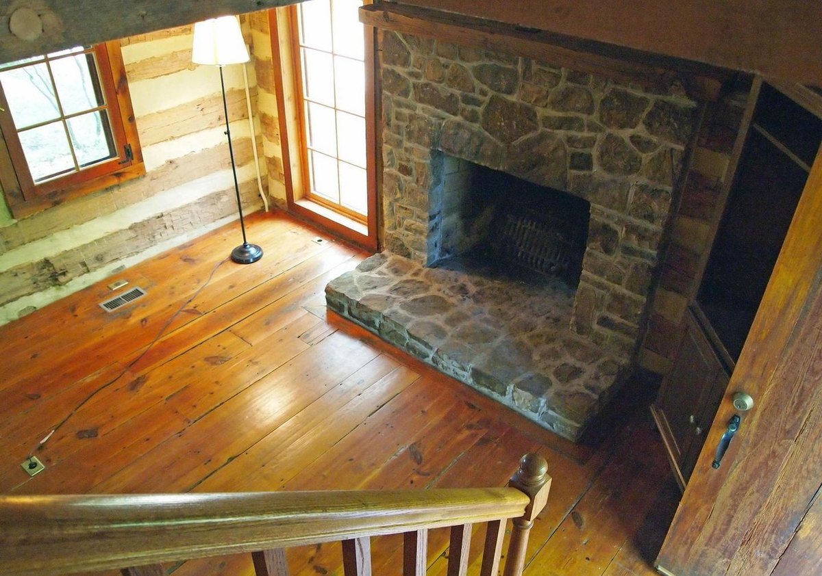
The main room from the stair. From the July 2015 listing; photograph date unknown. Image via Redfin / Bright MLS. 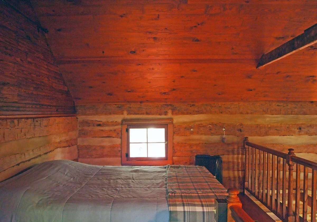
The upstairs room. From the July 2015 listing; photograph date unknown. Image via Redfin / Bright MLS. 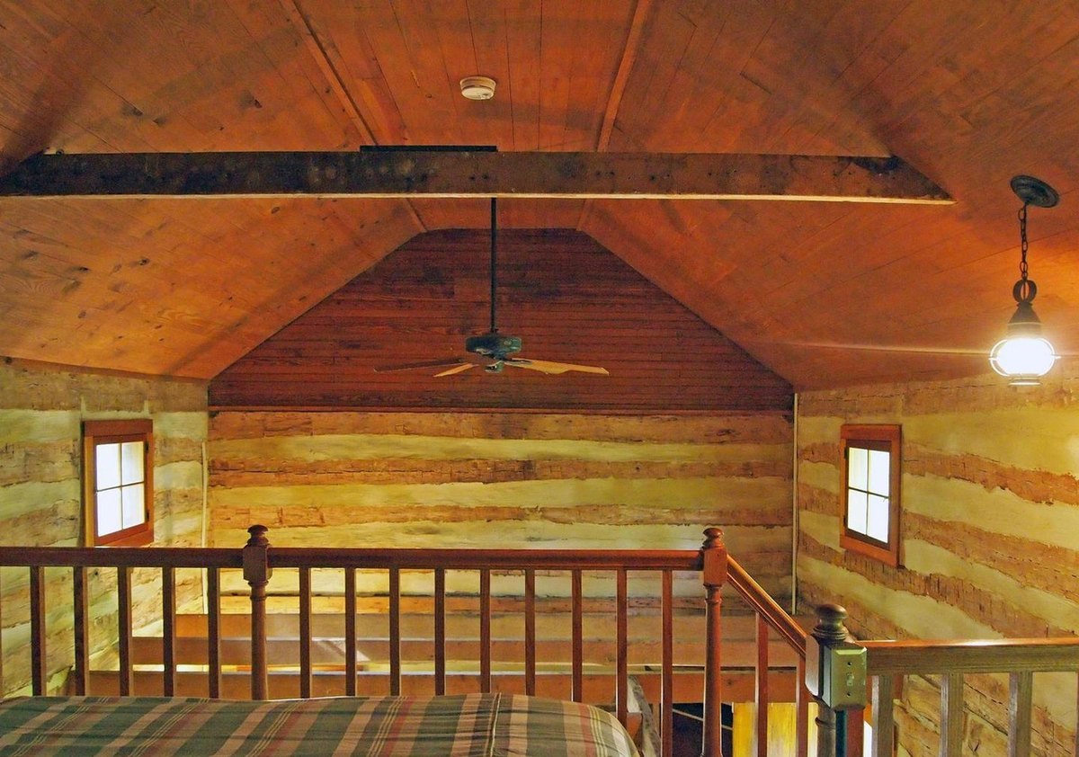
The upstairs room, toward the gable. From the July 2015 listing; photograph date unknown. Image via Redfin / Bright MLS. 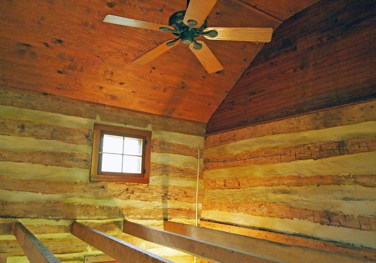
An upstairs window in the log gable. From the July 2015 listing; photograph date unknown. Image via Redfin / Bright MLS. 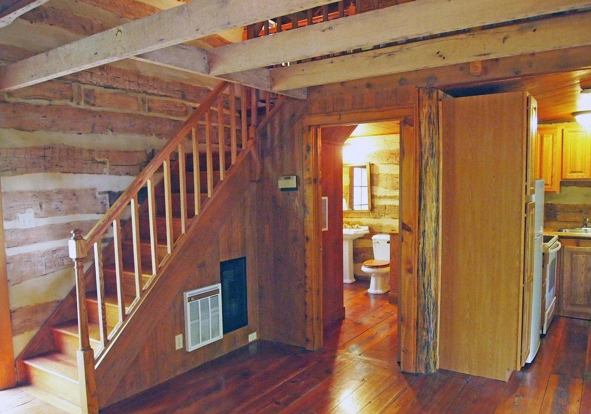
The stair, bathroom door and kitchen. From the July 2015 listing; photograph date unknown. Image via Redfin / Bright MLS. 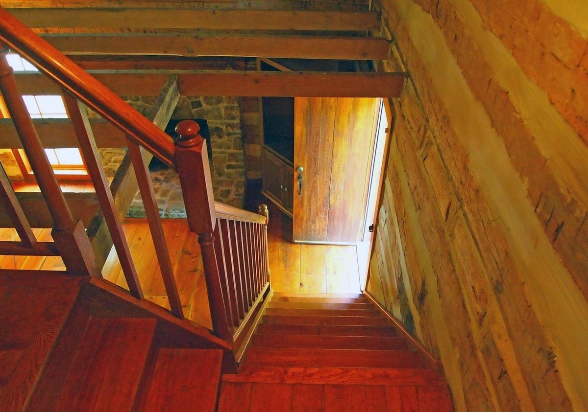
Looking down the stair. From the July 2015 listing; photograph date unknown. Image via Redfin / Bright MLS. 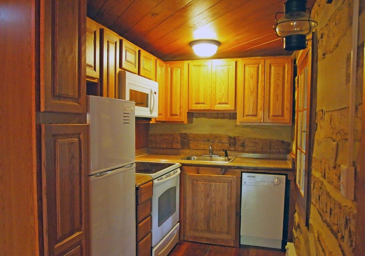
The kitchen. From the July 2015 listing; photograph date unknown. Image via Redfin / Bright MLS. 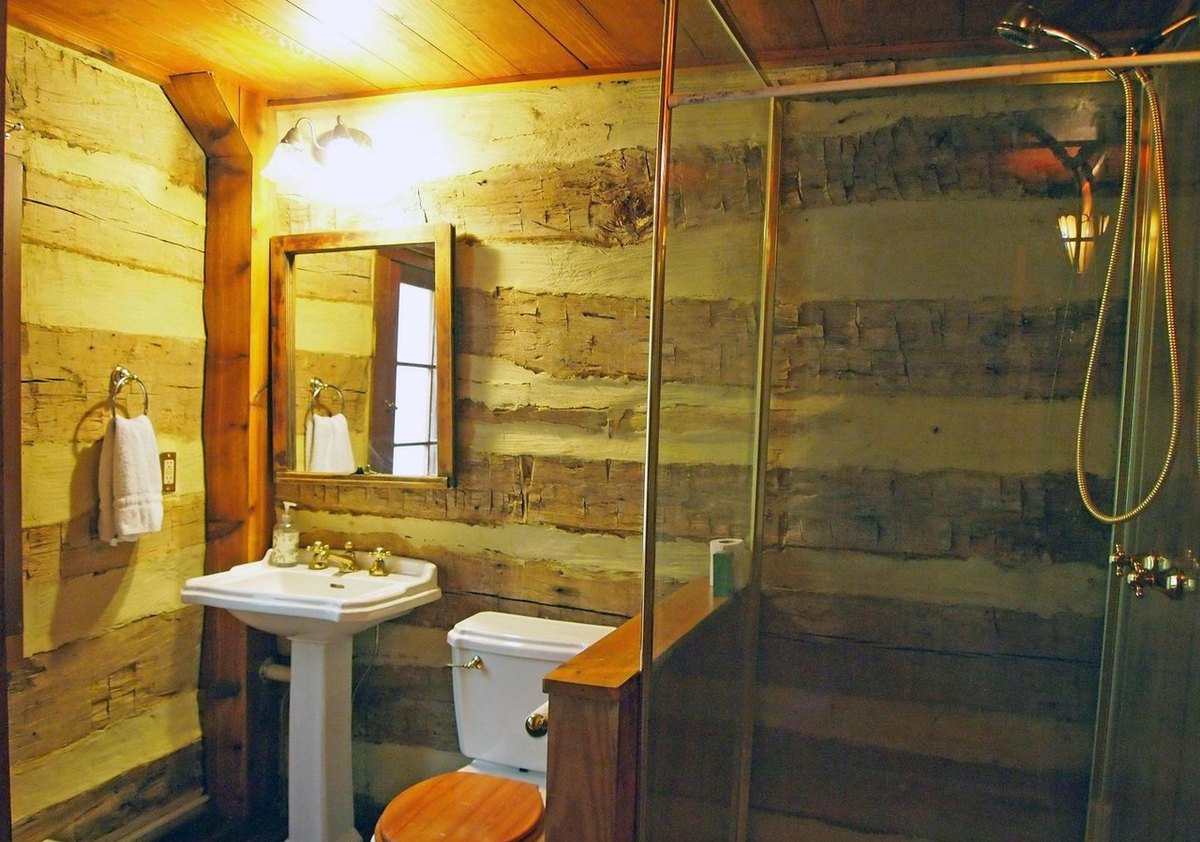
The bathroom. From the July 2015 listing; photograph date unknown. Image via Redfin / Bright MLS. 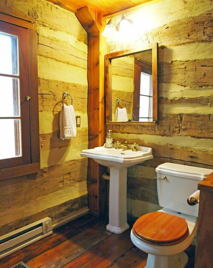
The bathroom, with its window. From the July 2015 listing; photograph date unknown. Image via Redfin / Bright MLS.
The March 2019 listing: outside
From the listing that went live on March 29, 2019.
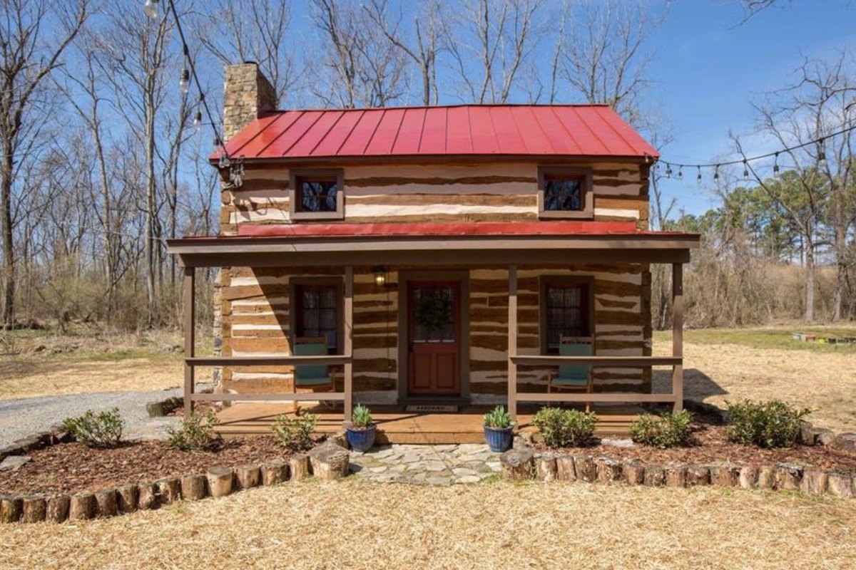
The front of the cabin, with its porch and chimney. From the March 2019 listing; photograph date unknown. Image via Redfin / Bright MLS. 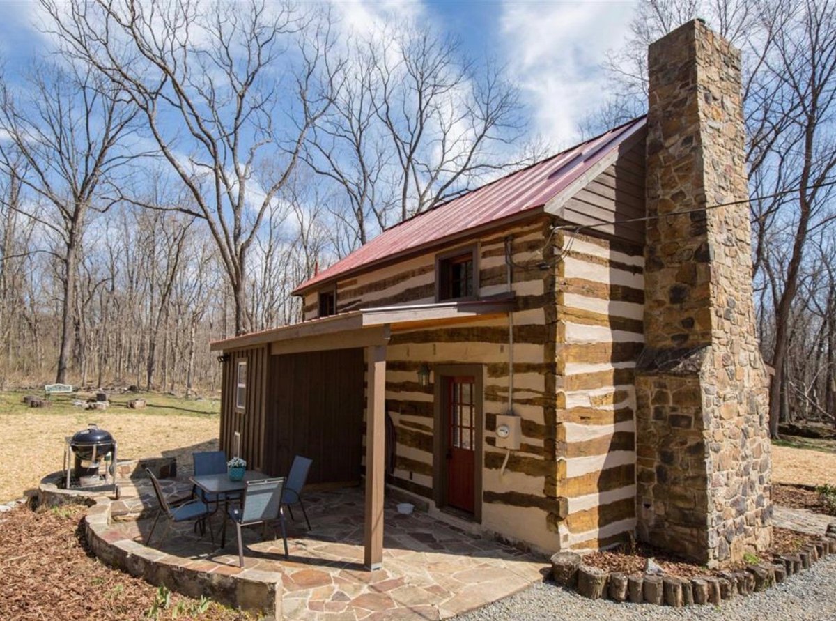
The chimney end and the covered back patio. From the March 2019 listing; photograph date unknown. Image via Redfin / Bright MLS. 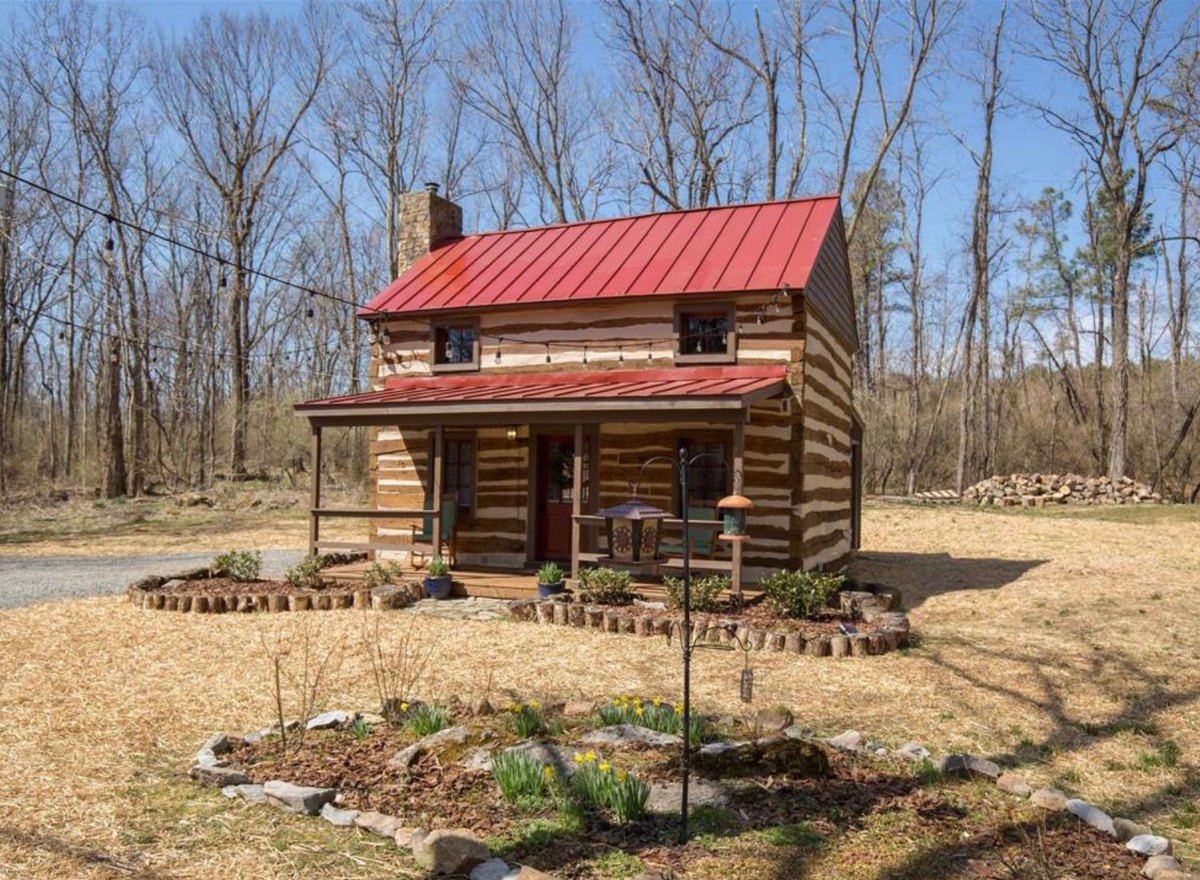
The front of the cabin beyond a planted bed. From the March 2019 listing; photograph date unknown. Image via Redfin / Bright MLS. 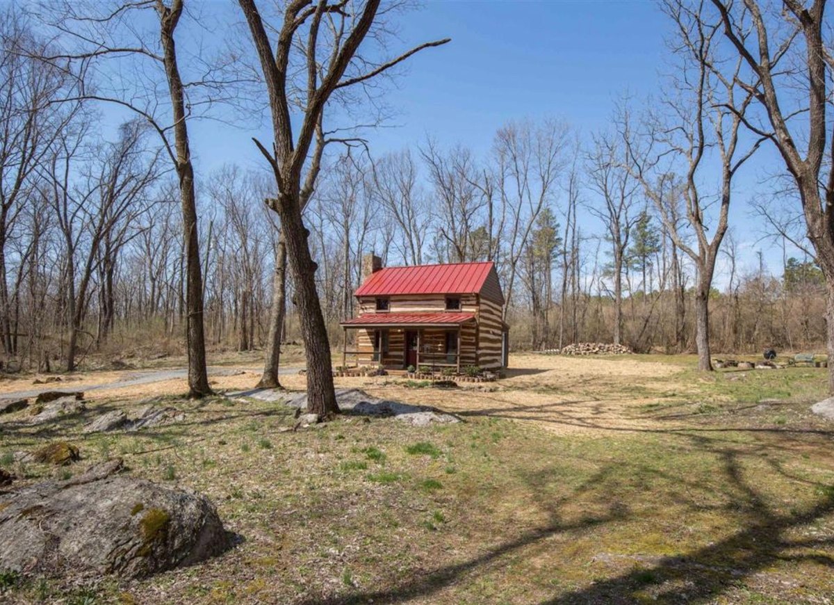
The cabin in its setting, seen from across the lawn. From the March 2019 listing; photograph date unknown. Image via Redfin / Bright MLS. 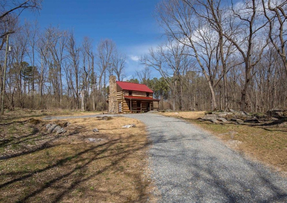
The gravel drive to the cabin. From the March 2019 listing; photograph date unknown. Image via Redfin / Bright MLS. 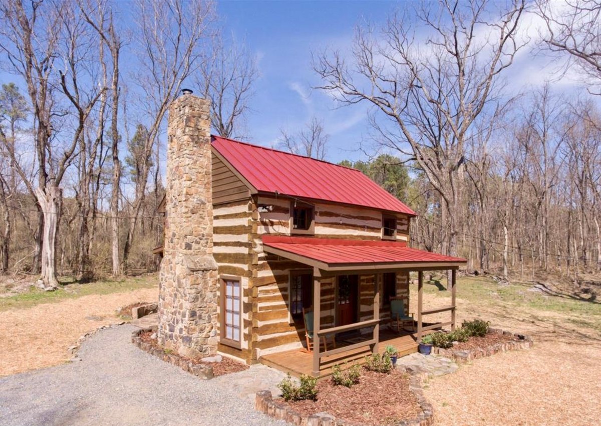
The chimney end, with its glazed door. From the March 2019 listing; photograph date unknown. Image via Redfin / Bright MLS. 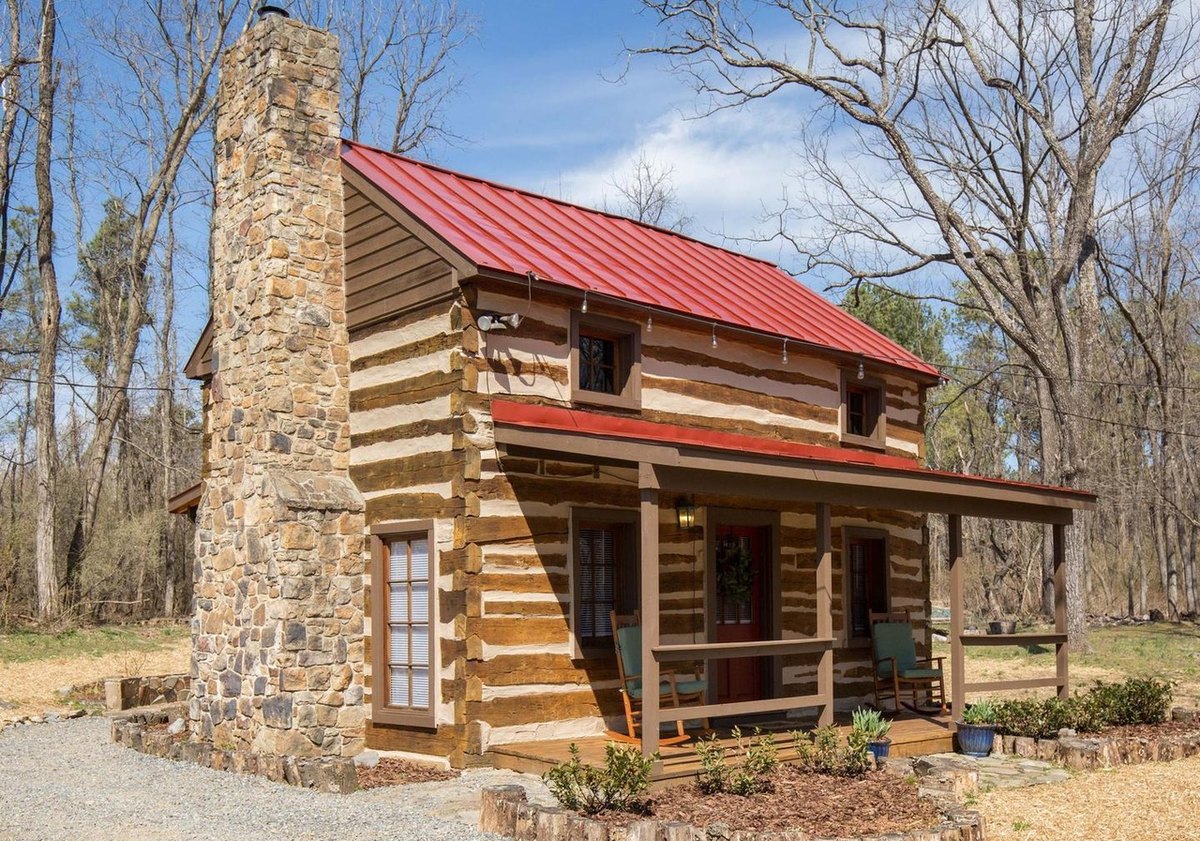
The chimney end and front porch. From the March 2019 listing; photograph date unknown. Image via Redfin / Bright MLS. 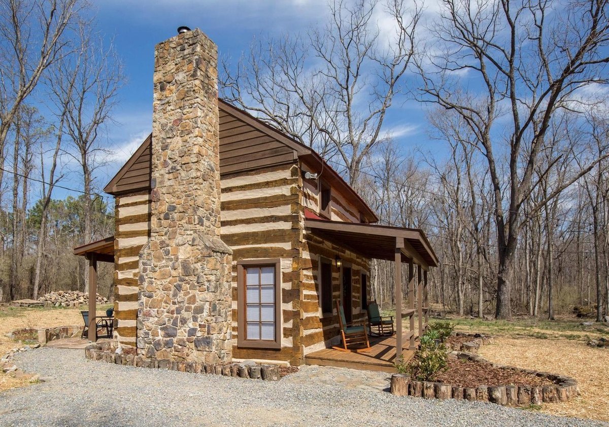
The chimney end from the corner. From the March 2019 listing; photograph date unknown. Image via Redfin / Bright MLS. 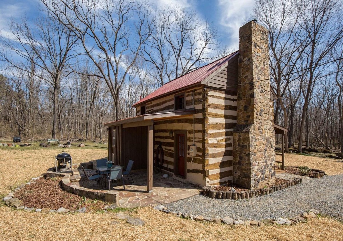
The back patio and chimney. From the March 2019 listing; photograph date unknown. Image via Redfin / Bright MLS. 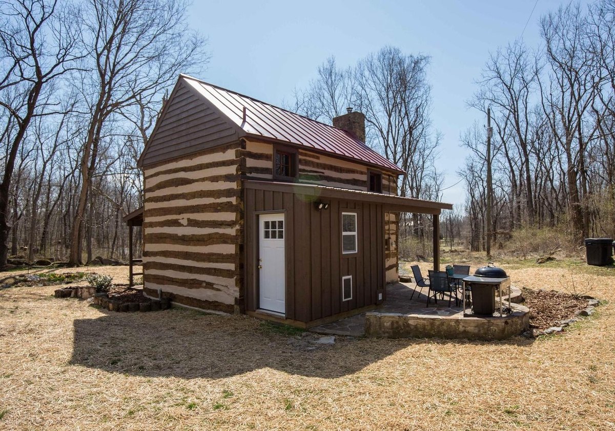
The back, with the addition's door. From the March 2019 listing; photograph date unknown. Image via Redfin / Bright MLS. 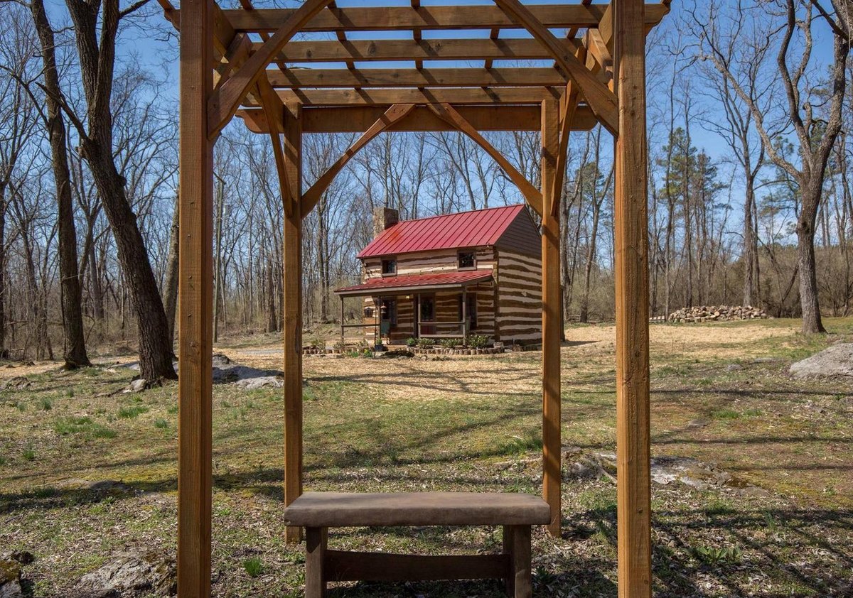
The cabin framed by a wooden arbor. From the March 2019 listing; photograph date unknown. Image via Redfin / Bright MLS. 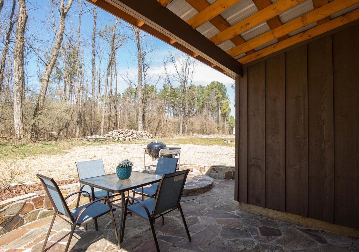
Under the back patio roof. From the March 2019 listing; photograph date unknown. Image via Redfin / Bright MLS.
The March 2019 listing: from the air
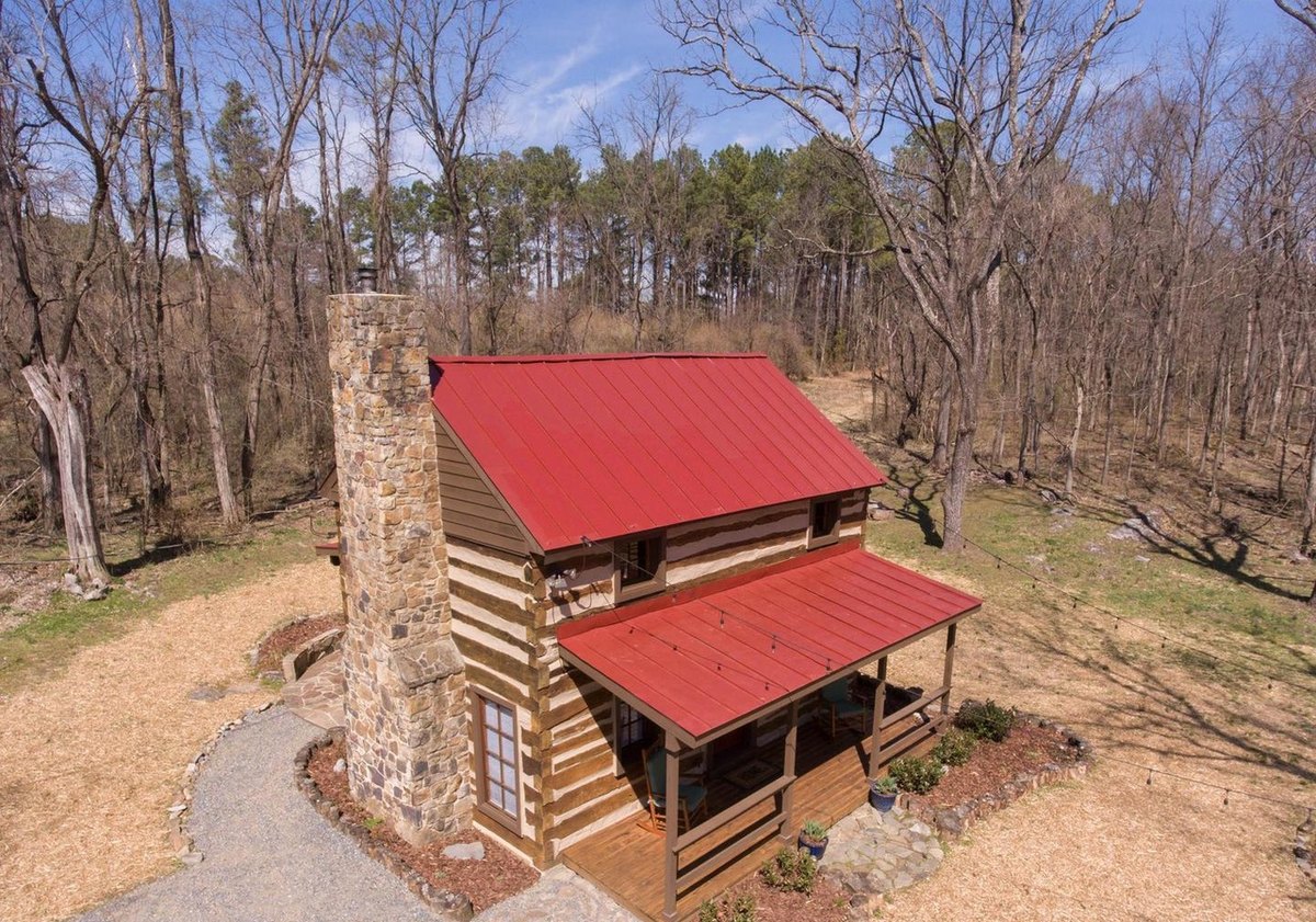
The cabin from the air. From the March 2019 listing; photograph date unknown. Image via Redfin / Bright MLS. 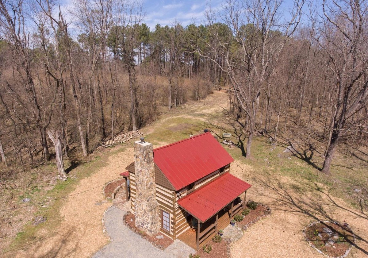
The cabin from the air, from the chimney side. From the March 2019 listing; photograph date unknown. Image via Redfin / Bright MLS. 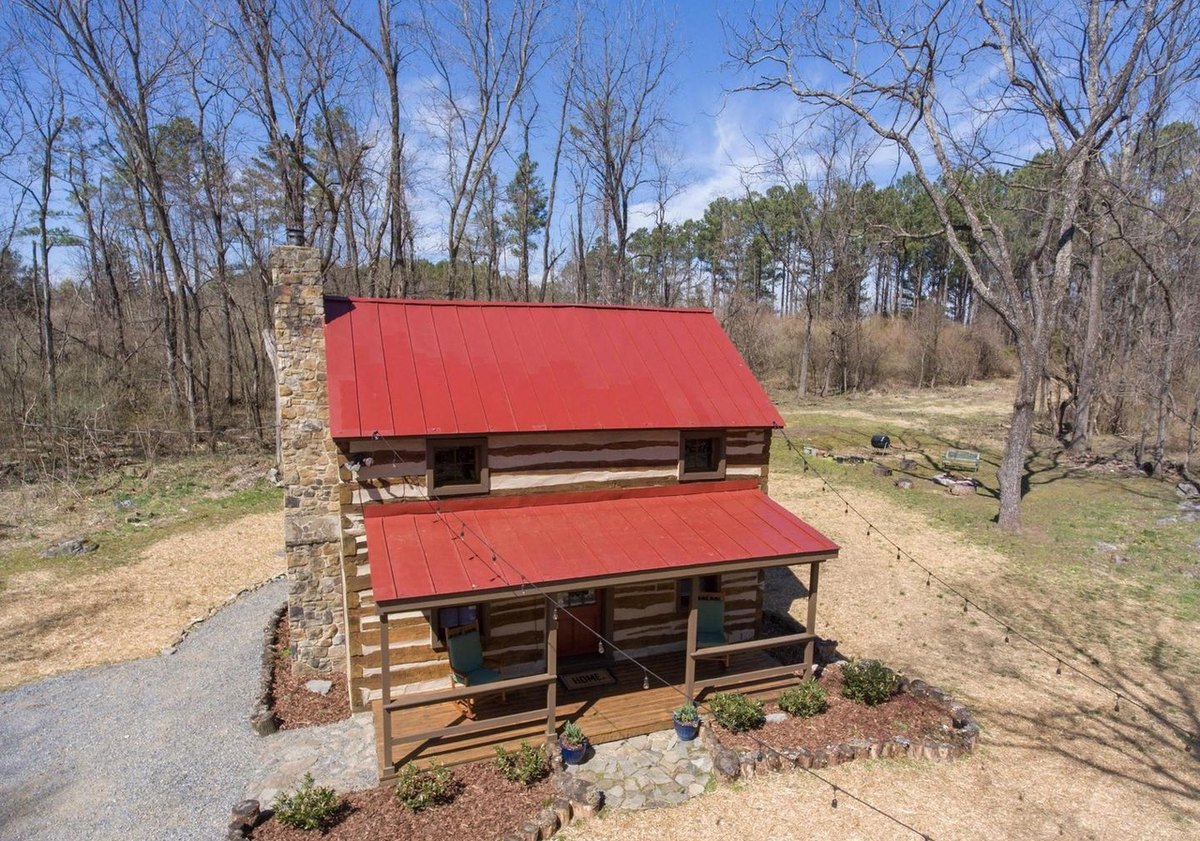
The front of the cabin from the air. From the March 2019 listing; photograph date unknown. Image via Redfin / Bright MLS. 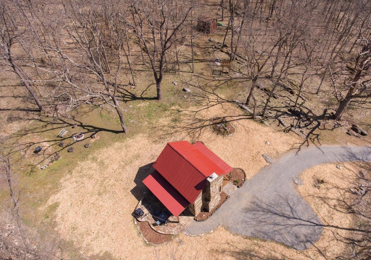
The cabin from overhead. From the March 2019 listing; photograph date unknown. Image via Redfin / Bright MLS. 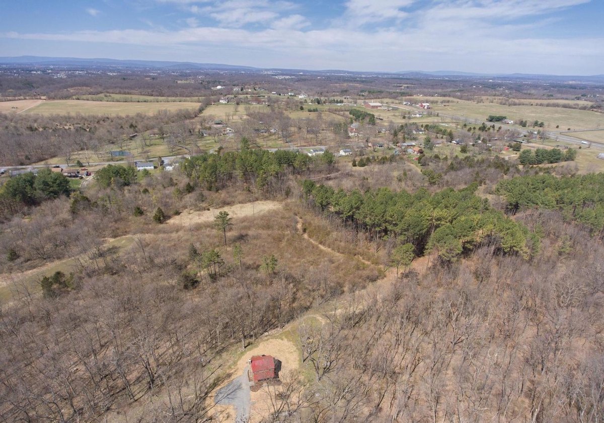
The cabin and the country around it. From the March 2019 listing; photograph date unknown. Image via Redfin / Bright MLS. 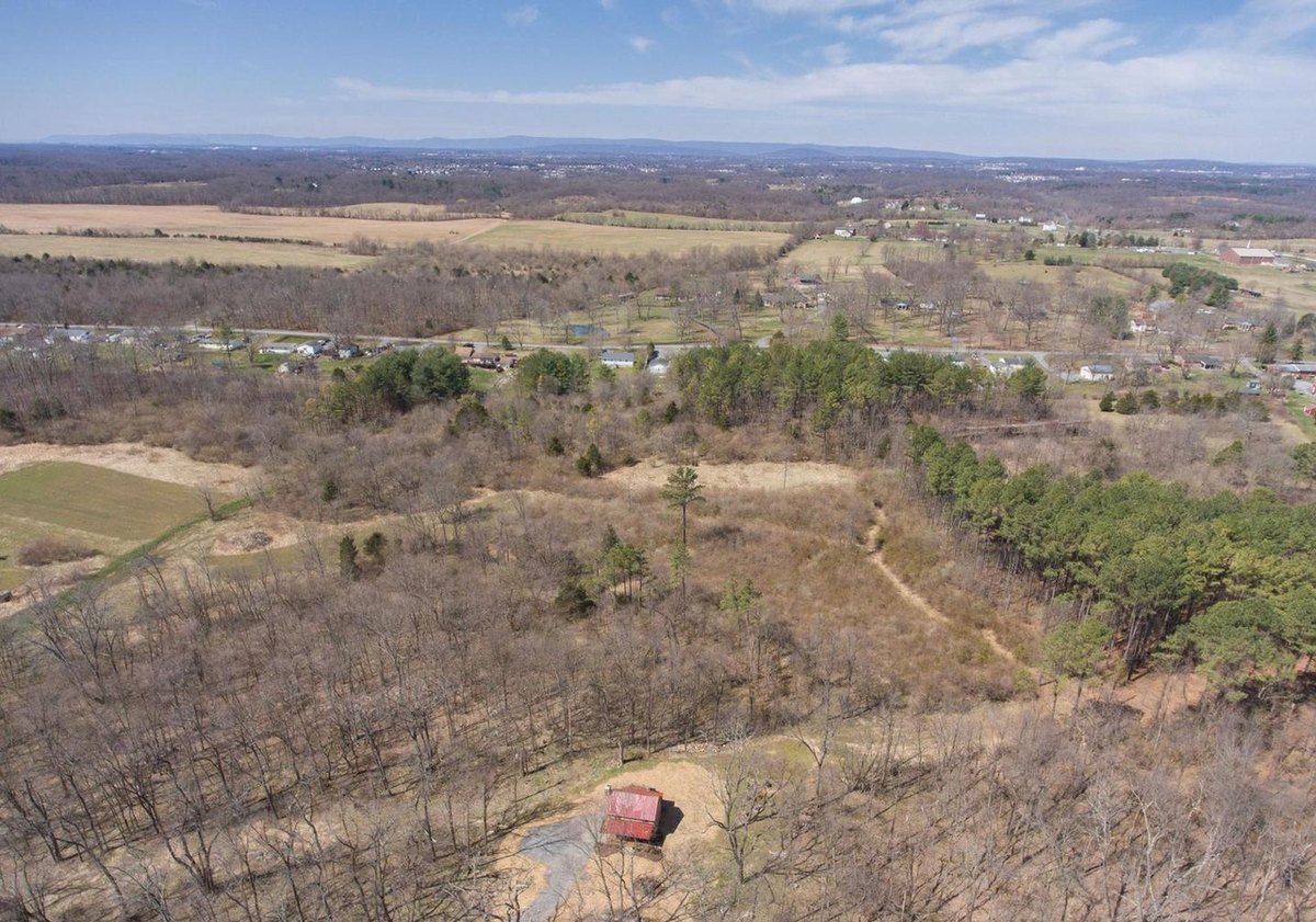
The cabin and the valley, looking out. From the March 2019 listing; photograph date unknown. Image via Redfin / Bright MLS. 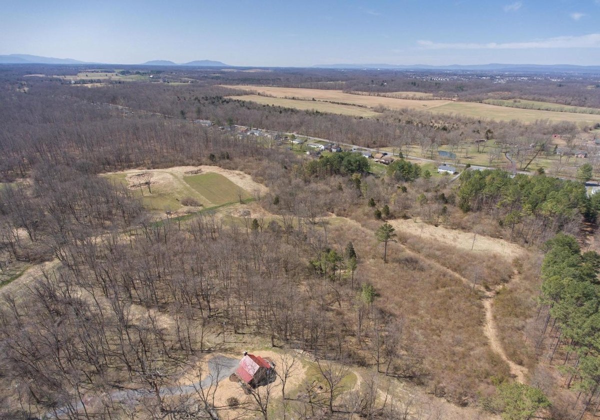
The cabin, the woods and the fields beyond. From the March 2019 listing; photograph date unknown. Image via Redfin / Bright MLS. 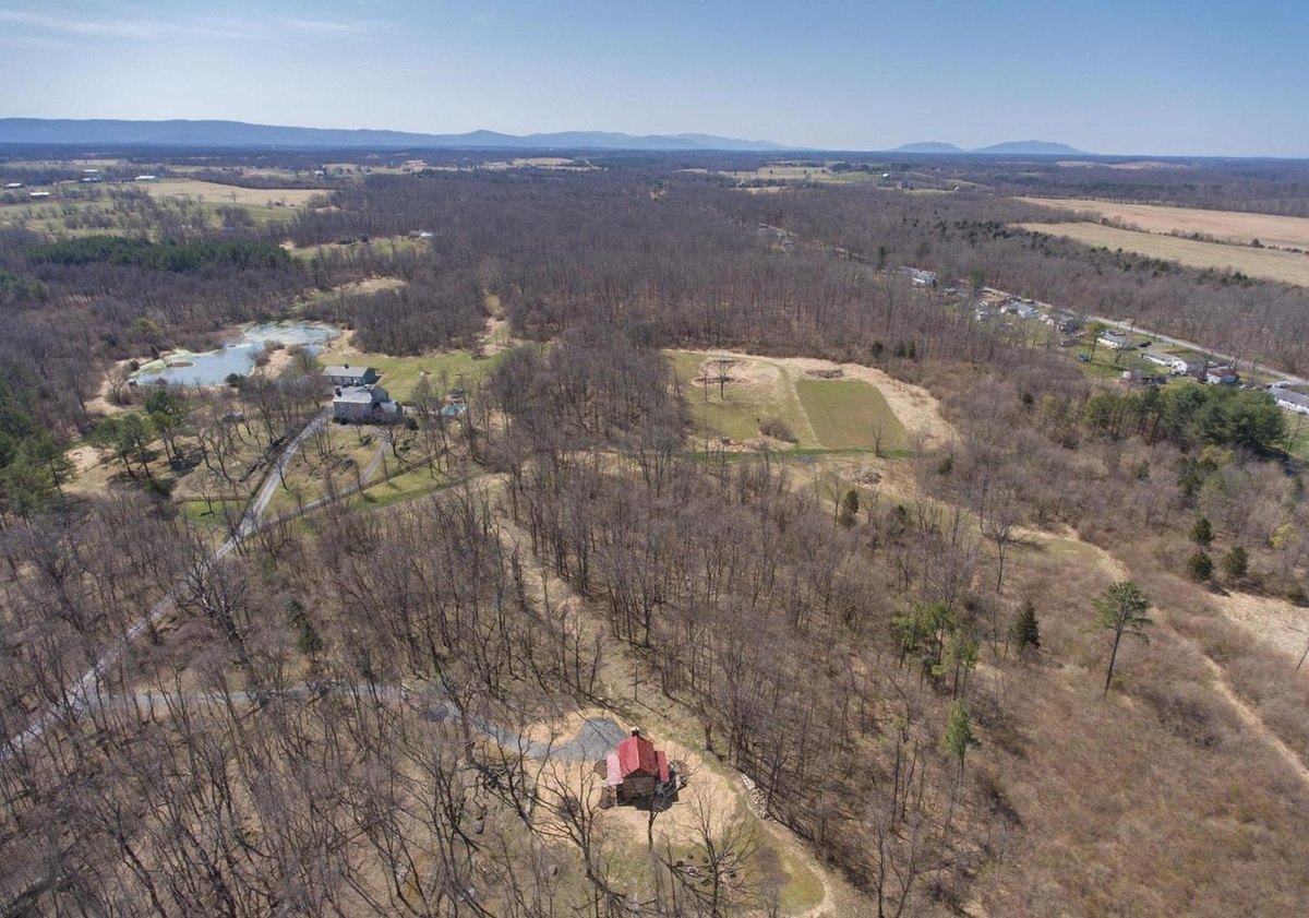
The cabin and a pond beyond the woods. From the March 2019 listing; photograph date unknown. Image via Redfin / Bright MLS. 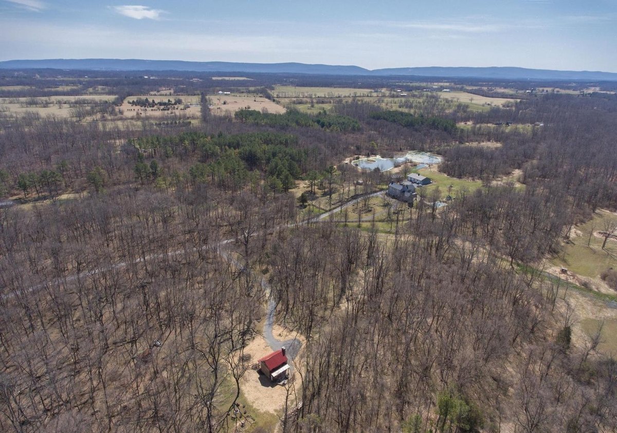
The cabin in its clearing, looking north. From the March 2019 listing; photograph date unknown. Image via Redfin / Bright MLS. 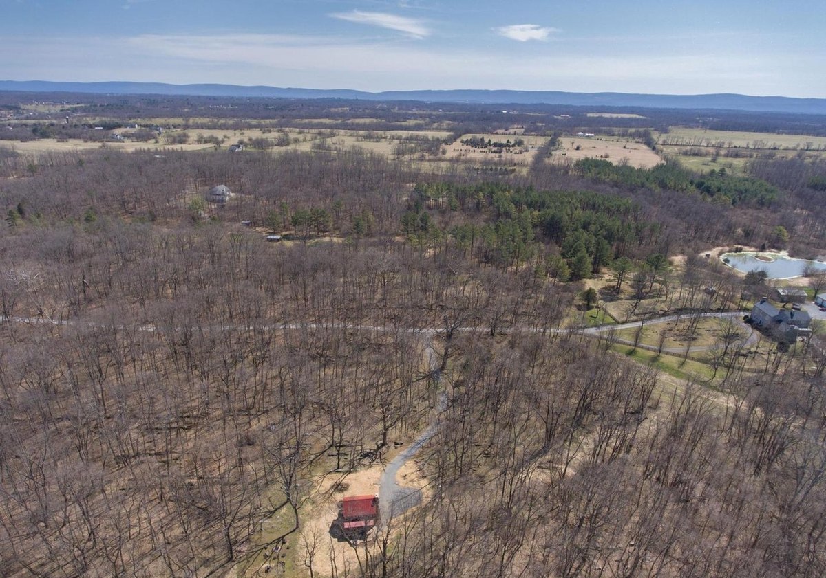
The drive through the woods to the cabin. From the March 2019 listing; photograph date unknown. Image via Redfin / Bright MLS. 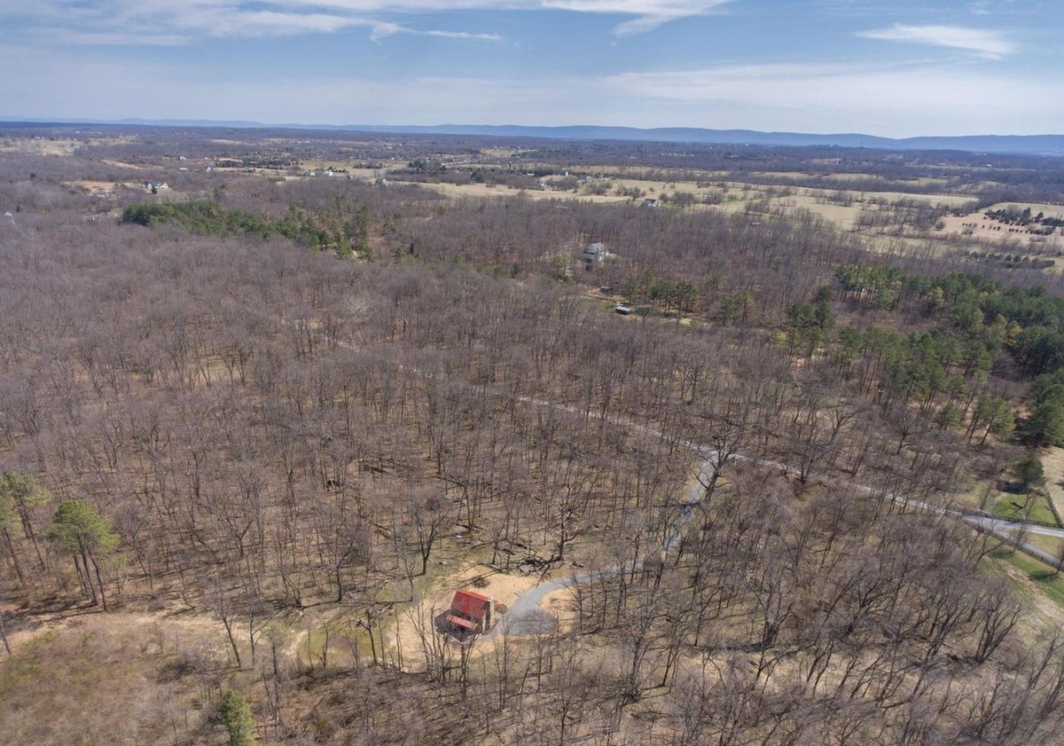
The cabin deep in the woods. From the March 2019 listing; photograph date unknown. Image via Redfin / Bright MLS. 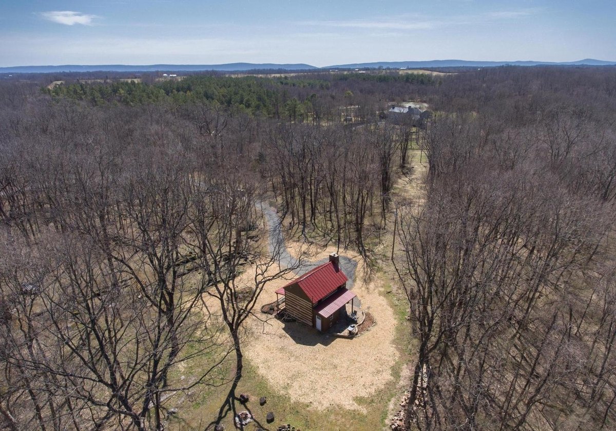
The cabin from above the treetops. From the March 2019 listing; photograph date unknown. Image via Redfin / Bright MLS.
The March 2019 listing: inside
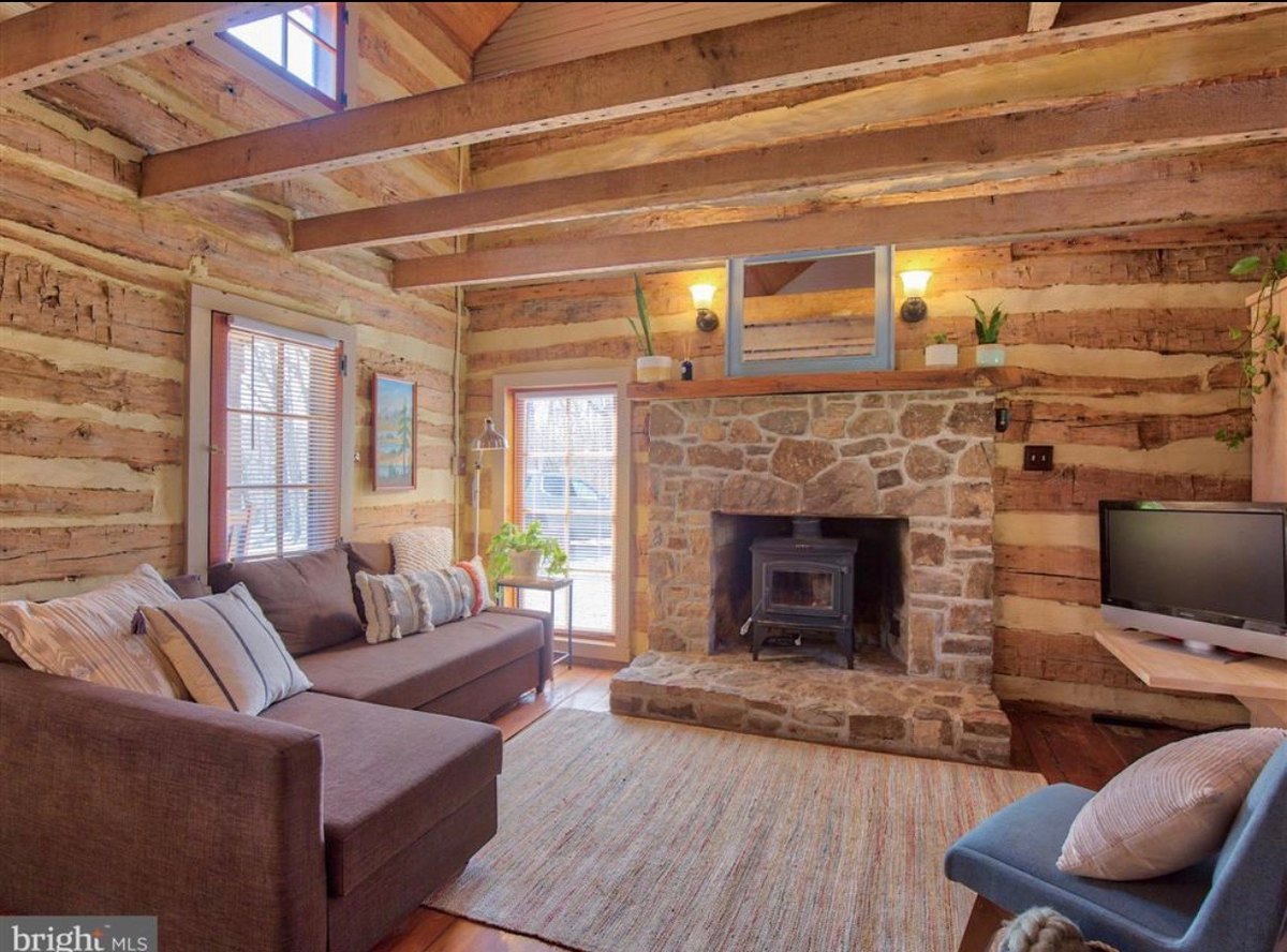
The main room, with its stone fireplace. From the March 2019 listing, as a screen image the owner saved; photograph date unknown. Image via Redfin / Bright MLS. 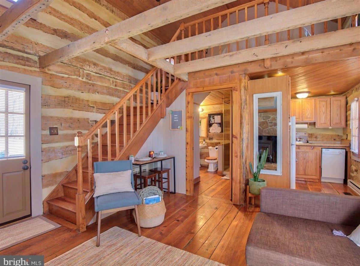
The staircase, with the bathroom and kitchen beyond. From the March 2019 listing, as a screen image the owner saved; photograph date unknown. Image via Redfin / Bright MLS. 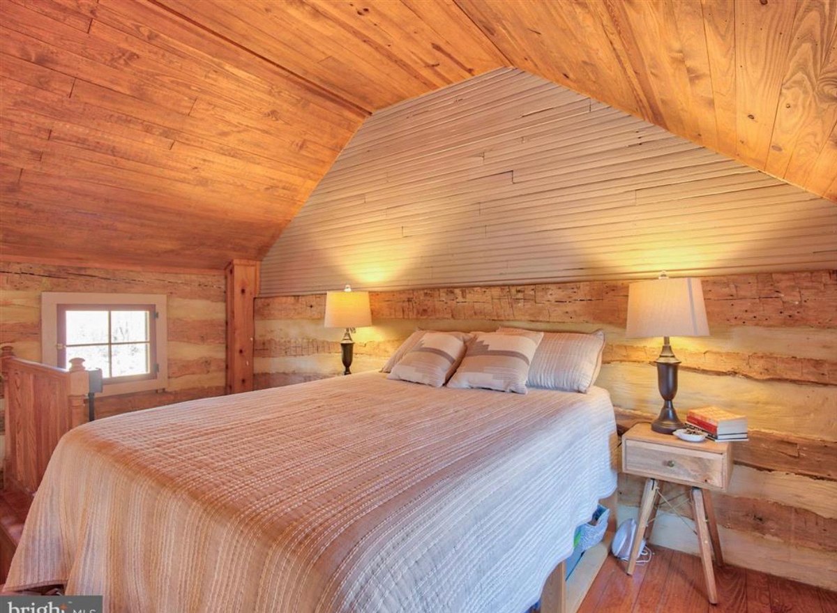
An upstairs bedroom under the roof. From the March 2019 listing, as a screen image the owner saved; photograph date unknown. Image via Redfin / Bright MLS. 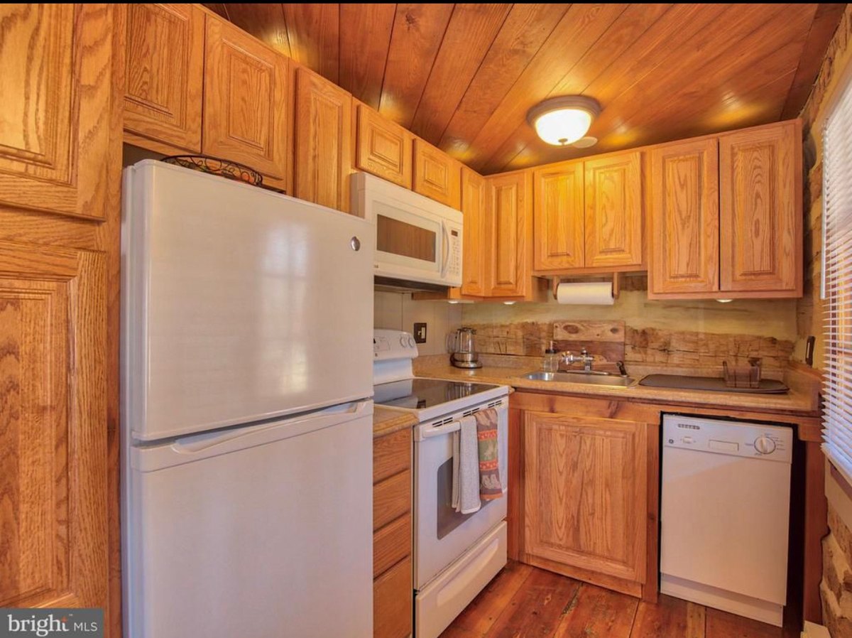
The kitchen. From the March 2019 listing, as a screen image the owner saved; photograph date unknown. Image via Redfin / Bright MLS. 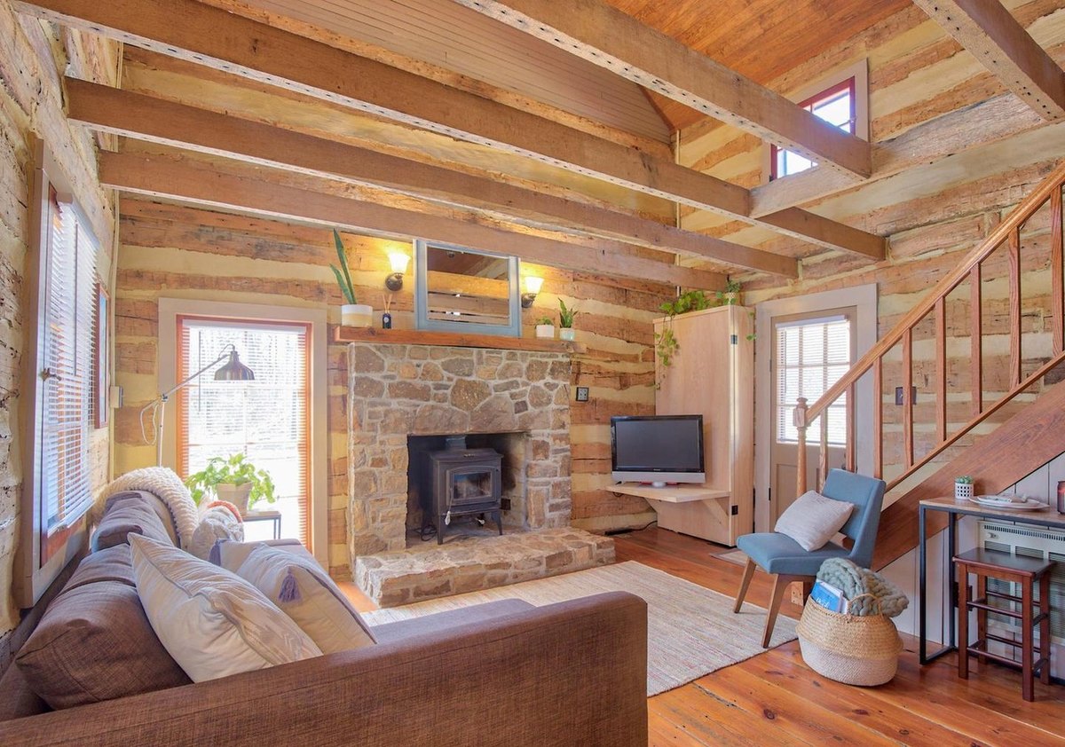
The main room, with the stair. From the March 2019 listing; photograph date unknown. Image via Redfin / Bright MLS. 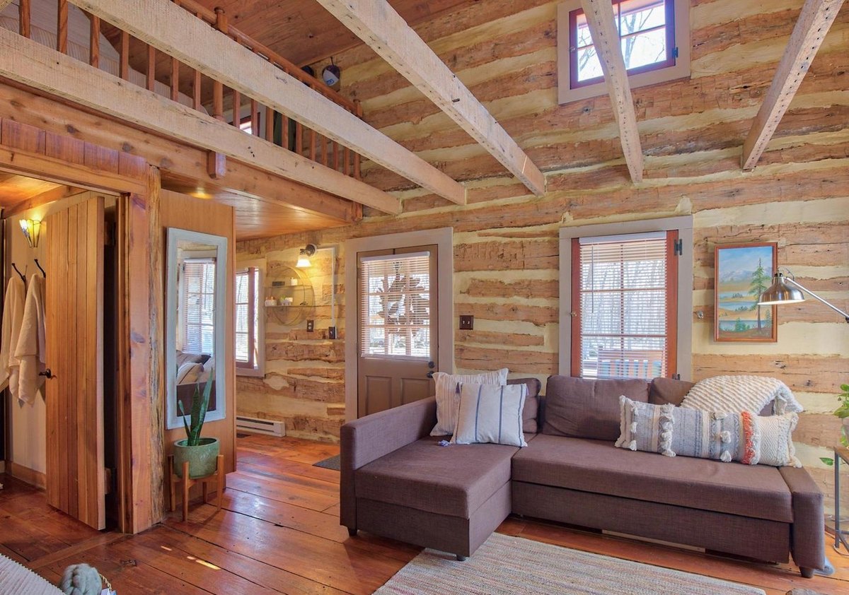
The main room, toward the front door. From the March 2019 listing; photograph date unknown. Image via Redfin / Bright MLS. 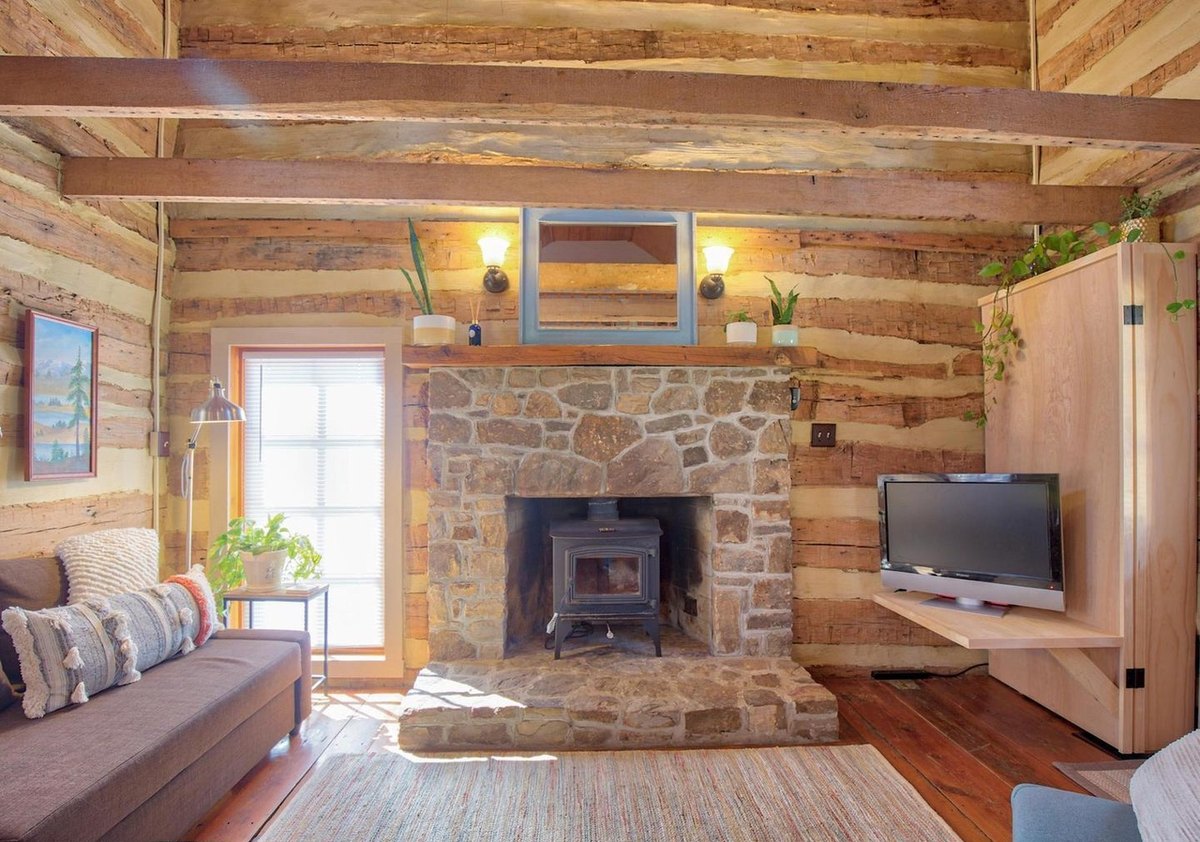
The fireplace wall. From the March 2019 listing; photograph date unknown. Image via Redfin / Bright MLS. 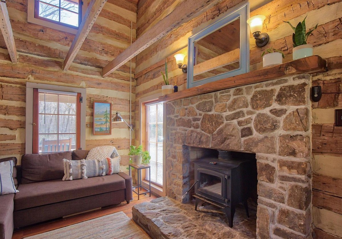
The wood stove and stone hearth. From the March 2019 listing; photograph date unknown. Image via Redfin / Bright MLS. 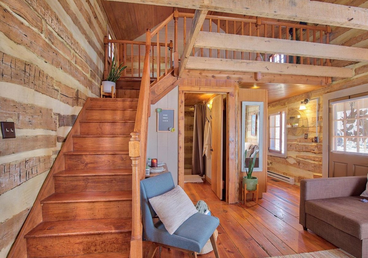
The stair from the main room. From the March 2019 listing; photograph date unknown. Image via Redfin / Bright MLS. 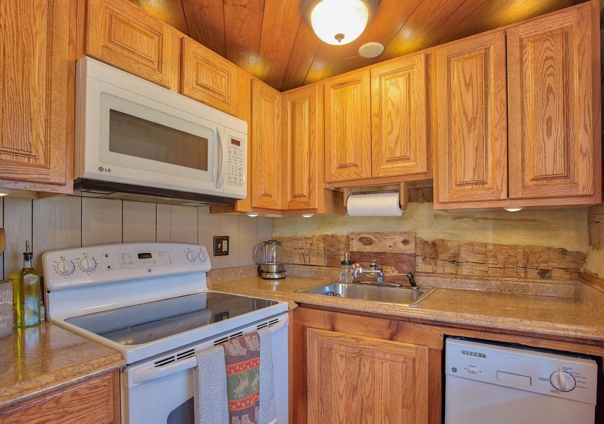
The kitchen counter and stove. From the March 2019 listing; photograph date unknown. Image via Redfin / Bright MLS. 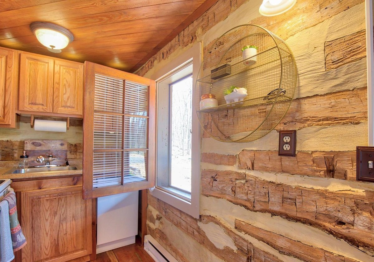
The kitchen's hewn log wall. From the March 2019 listing; photograph date unknown. Image via Redfin / Bright MLS. 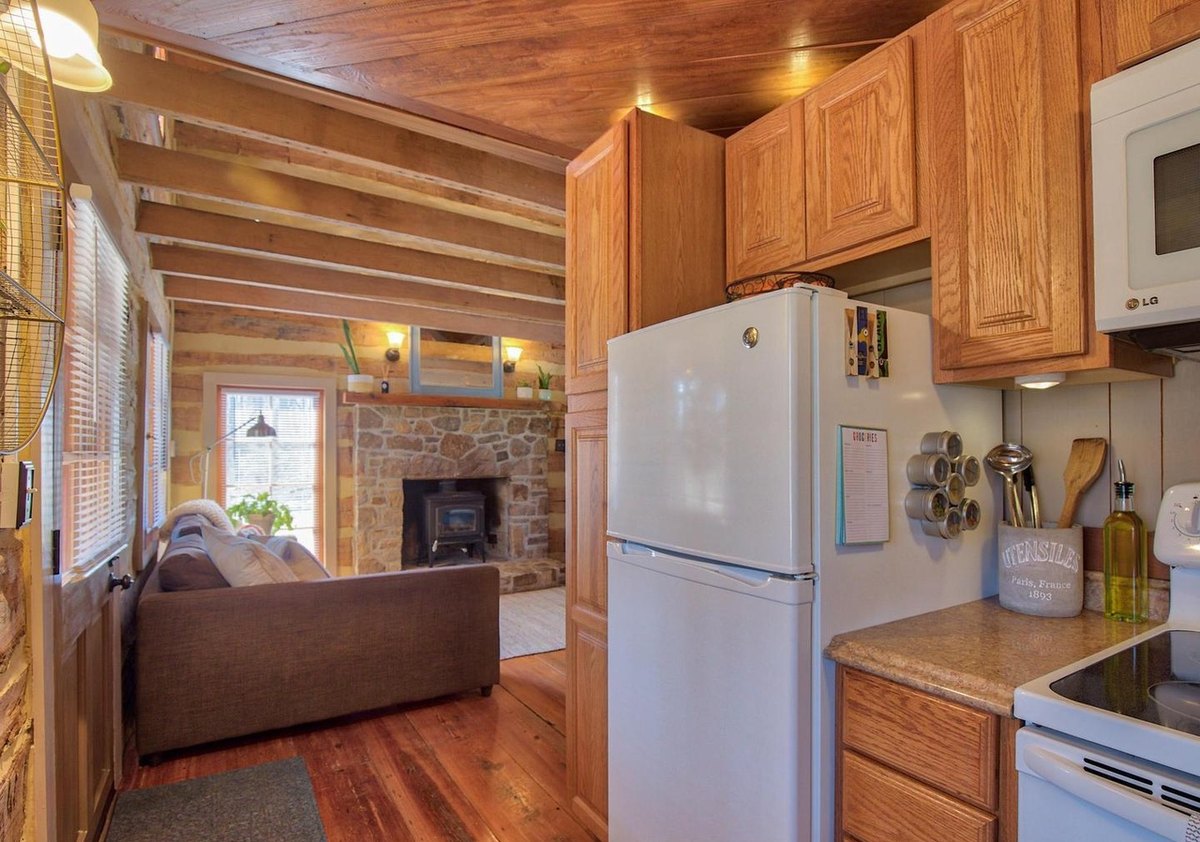
From the kitchen into the main room. From the March 2019 listing; photograph date unknown. Image via Redfin / Bright MLS. 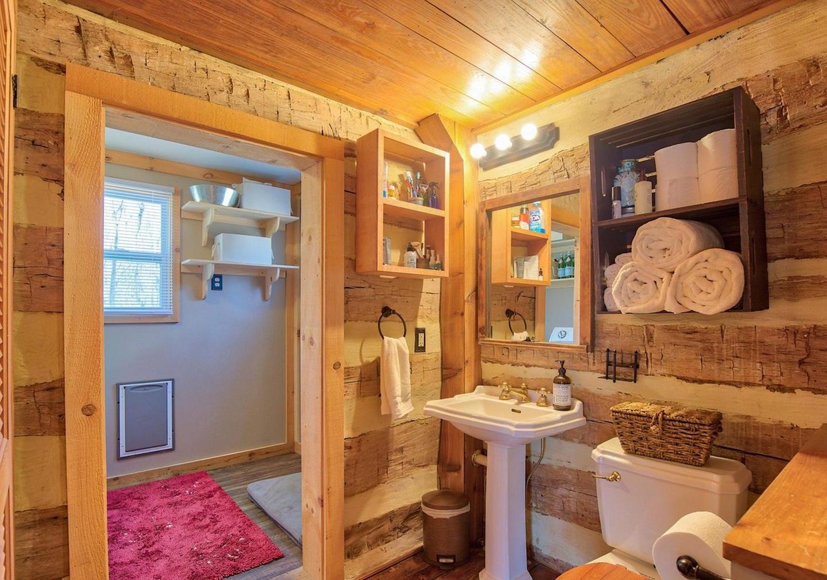
The bathroom. From the March 2019 listing; photograph date unknown. Image via Redfin / Bright MLS. 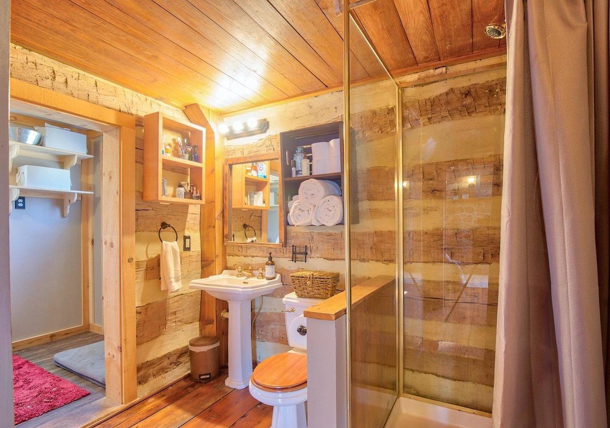
The bathroom and shower. From the March 2019 listing; photograph date unknown. Image via Redfin / Bright MLS. 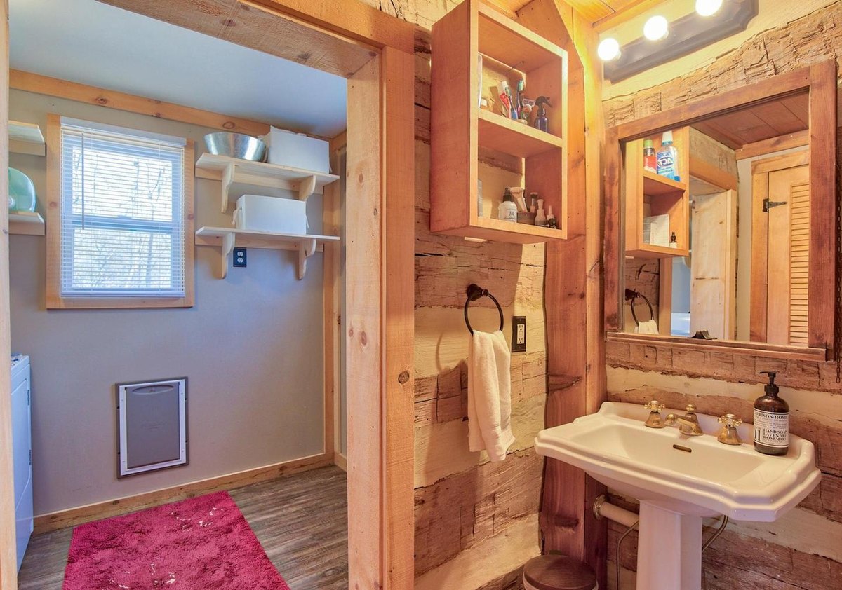
The bathroom sink and cabinet. From the March 2019 listing; photograph date unknown. Image via Redfin / Bright MLS. 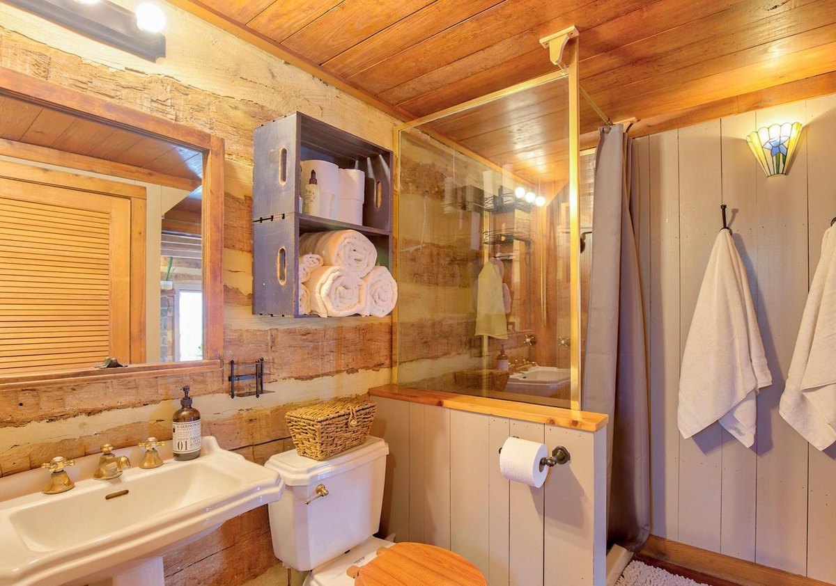
The bathroom, toward the louvered door. From the March 2019 listing; photograph date unknown. Image via Redfin / Bright MLS. 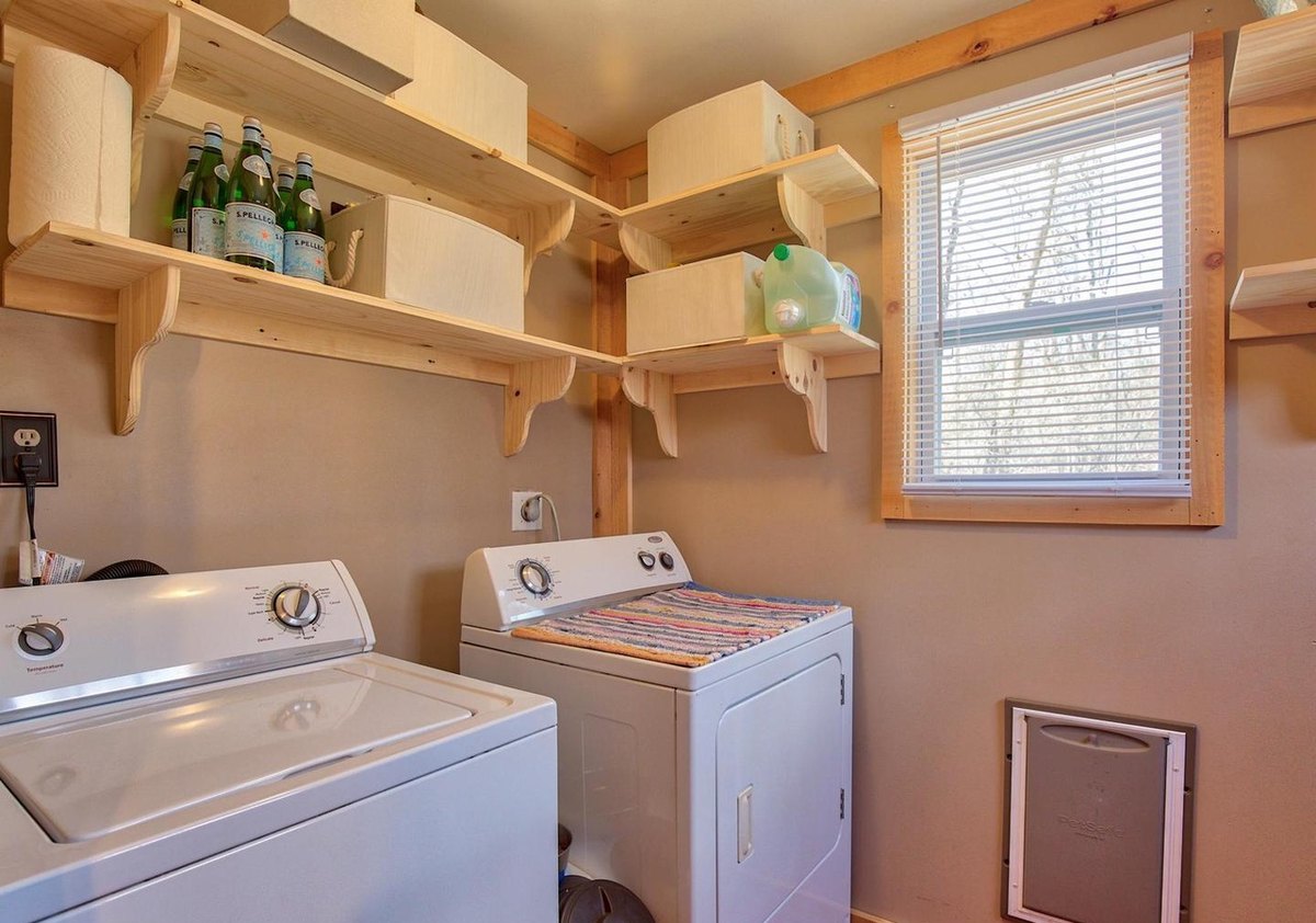
The laundry room. From the March 2019 listing; photograph date unknown. Image via Redfin / Bright MLS. 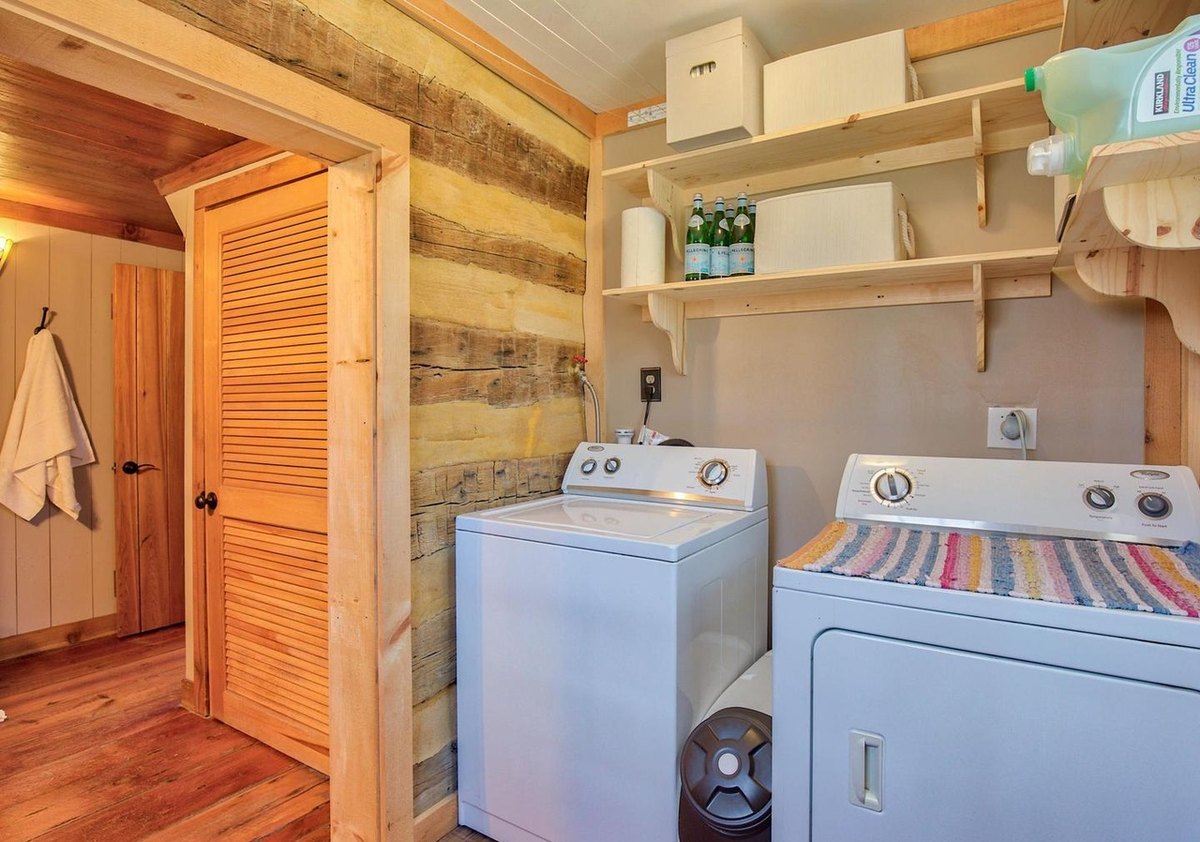
The laundry room and its door. From the March 2019 listing; photograph date unknown. Image via Redfin / Bright MLS. 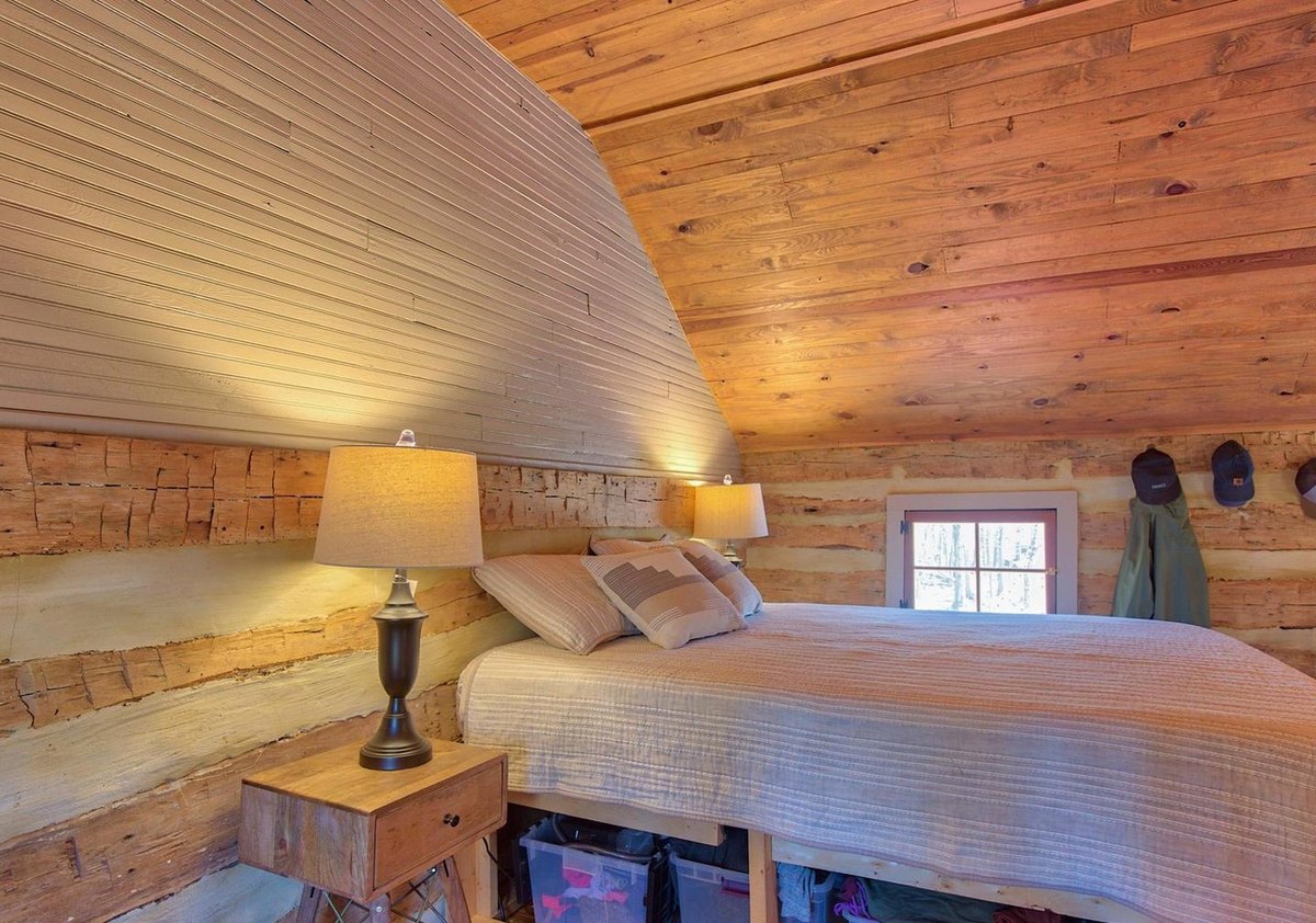
The upstairs bedroom. From the March 2019 listing; photograph date unknown. Image via Redfin / Bright MLS. 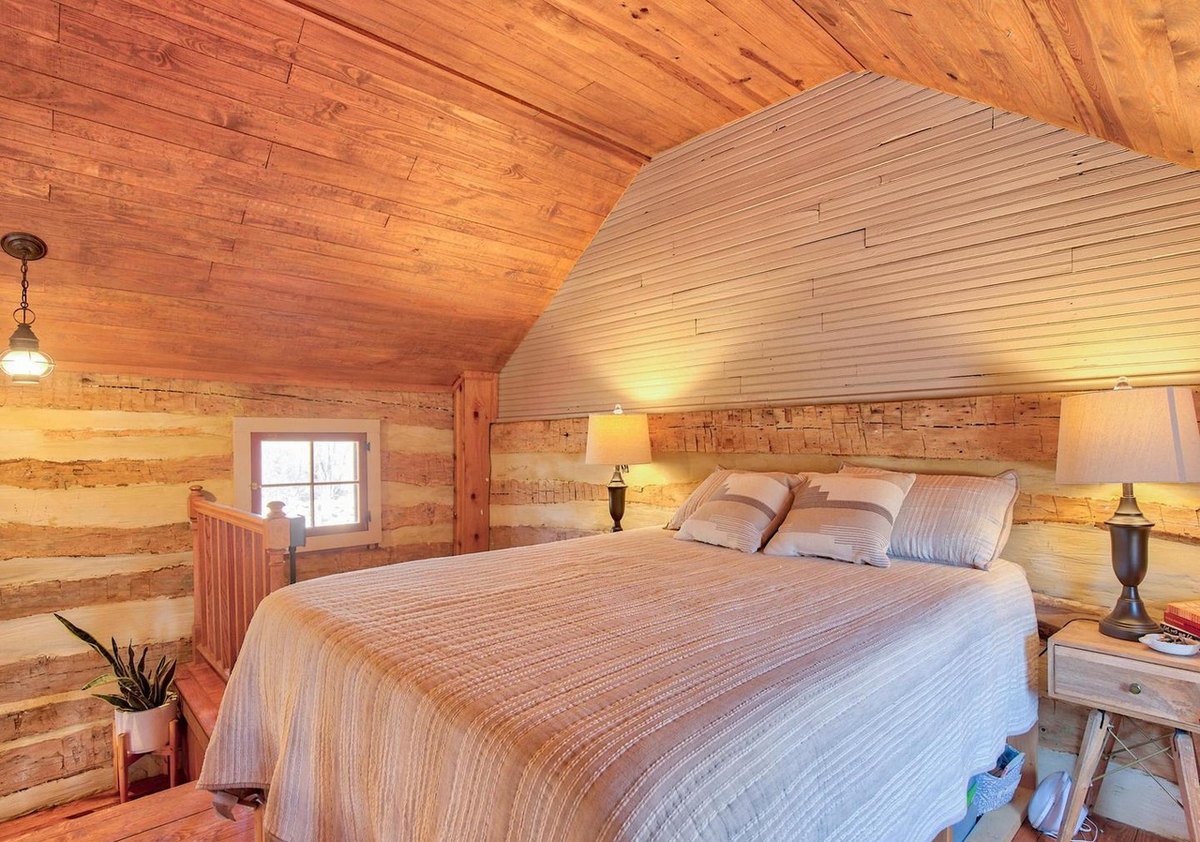
The upstairs bedroom, head-on. From the March 2019 listing; photograph date unknown. Image via Redfin / Bright MLS. 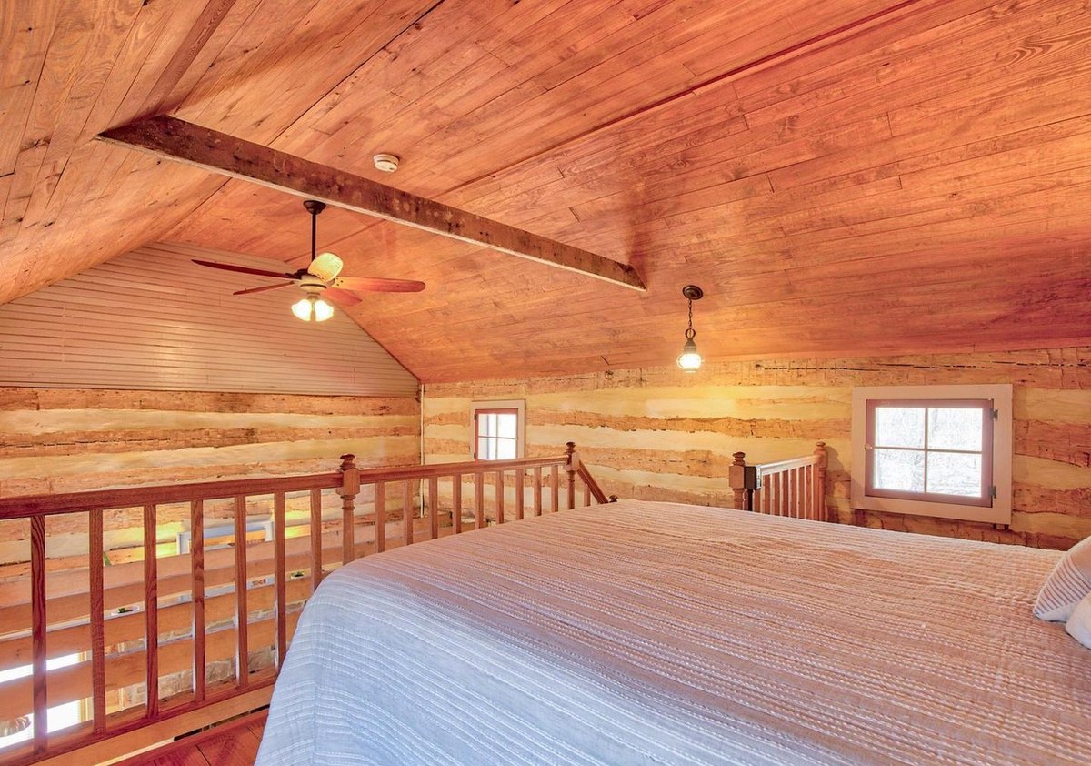
The upstairs room toward the gable. From the March 2019 listing; photograph date unknown. Image via Redfin / Bright MLS. 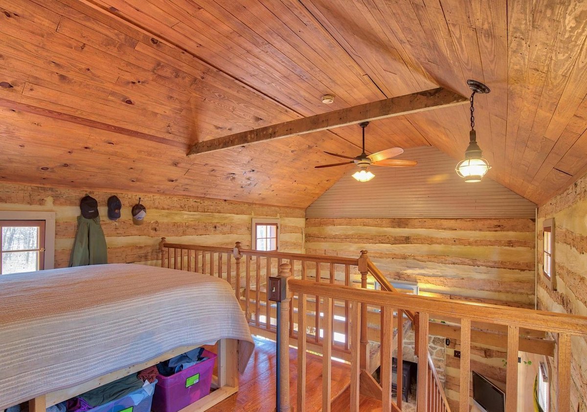
The upstairs room and stair railing. From the March 2019 listing; photograph date unknown. Image via Redfin / Bright MLS.
Michael Oak’s photographs, 2019–2023
Each is dated from its camera record.
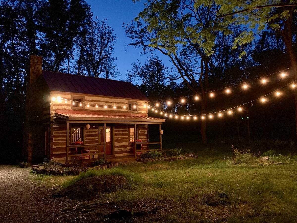
The cabin at dusk, May 2019. Photo courtesy of Michael Oak. 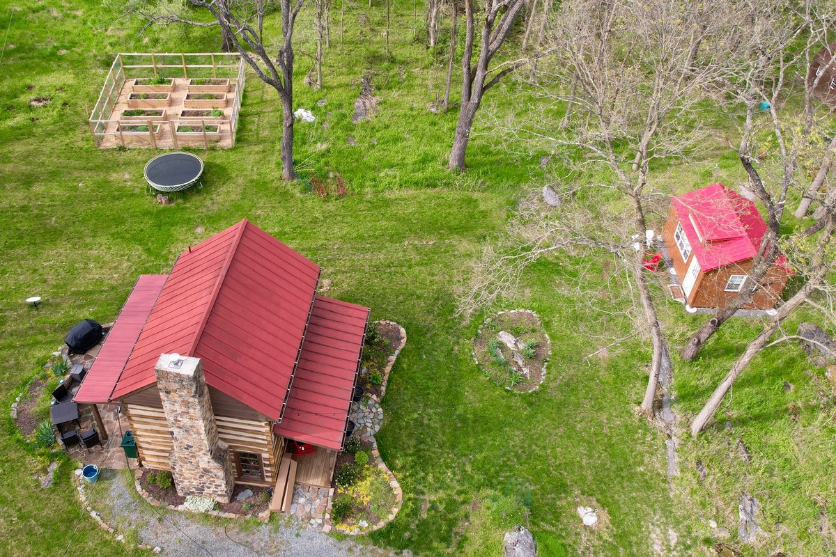
The cabin from above, April 2021, taken with a drone camera. Photo courtesy of Michael Oak. 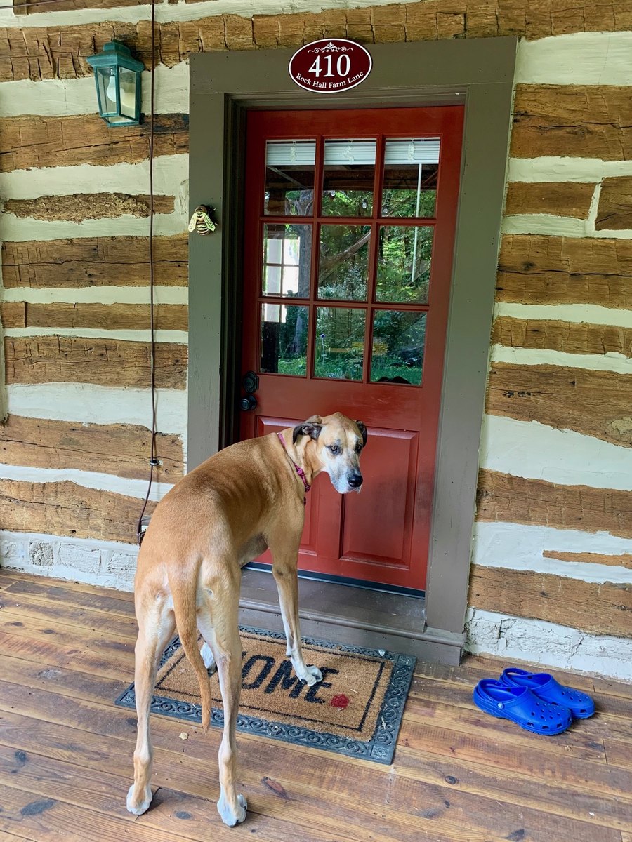
The front door, August 2019. Photo courtesy of Michael Oak. 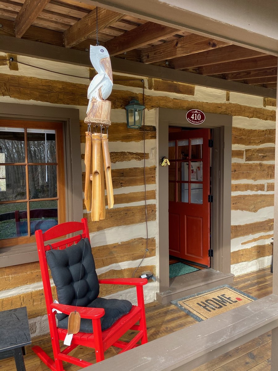
On the front porch, January 2020. Photo courtesy of Michael Oak. 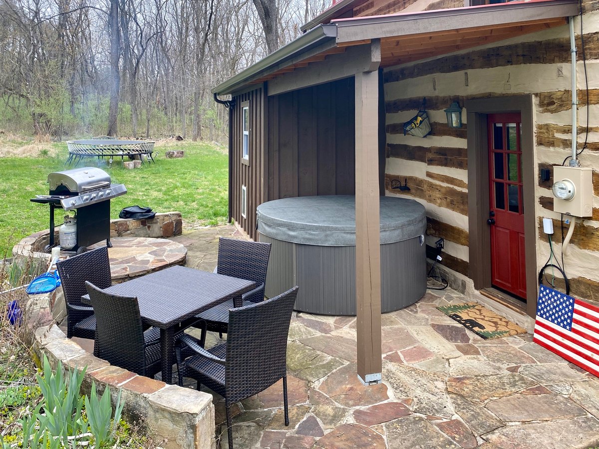
The back patio, March 2020. Photo courtesy of Michael Oak. 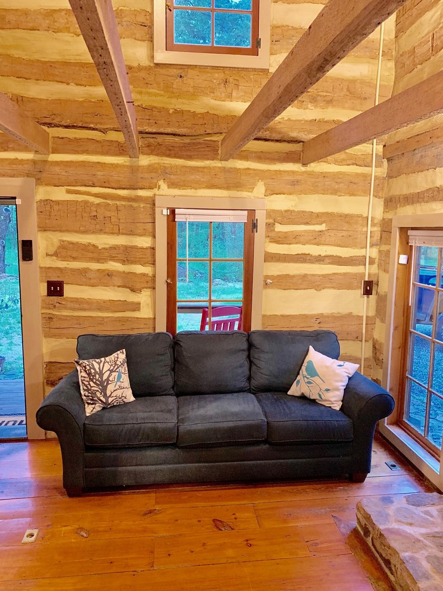
The main room, May 2019. Photo courtesy of Michael Oak. 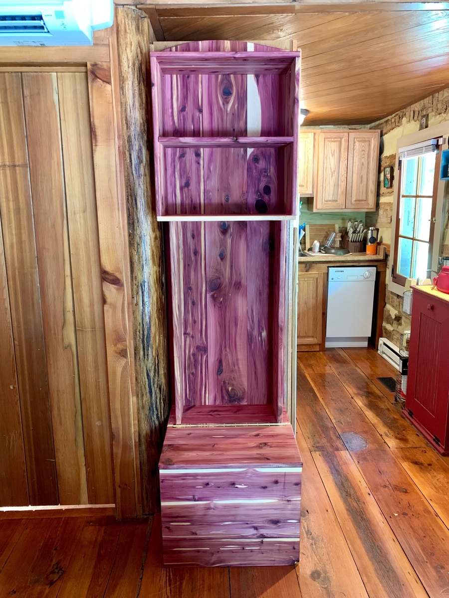
A new cedar cabinet, July 2019. Photo courtesy of Michael Oak. 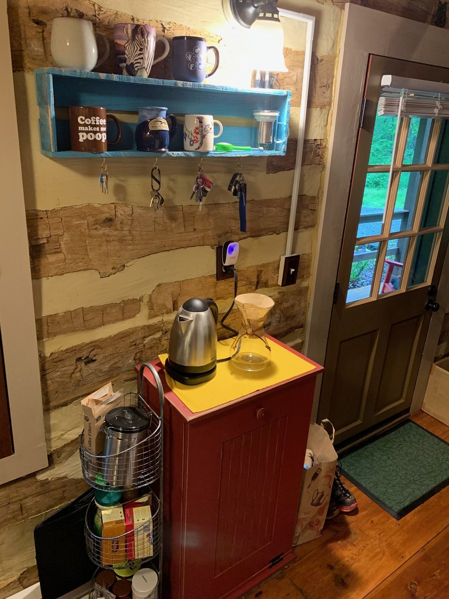
A coffee corner by the door, May 2019. Photo courtesy of Michael Oak. 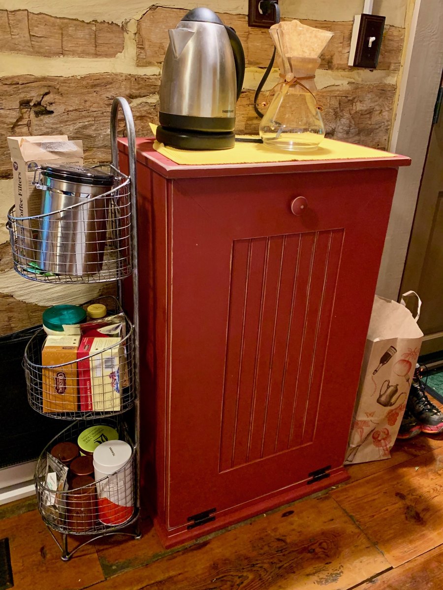
The same corner, closer, May 2019. Photo courtesy of Michael Oak. 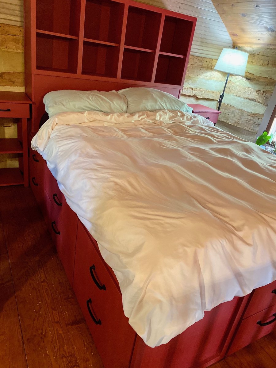
A bedroom, October 2019. Photo courtesy of Michael Oak. 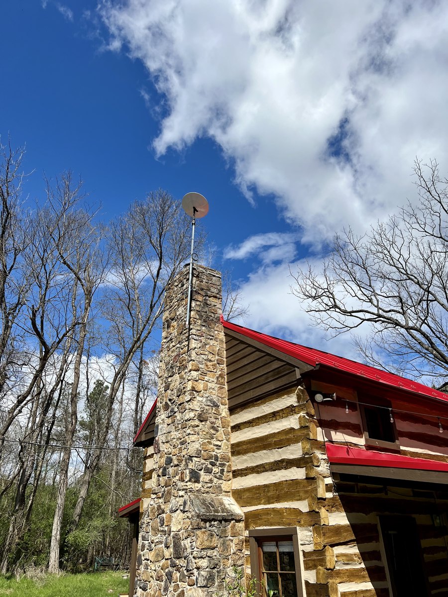
The chimney end, April 2022. Photo courtesy of Michael Oak. 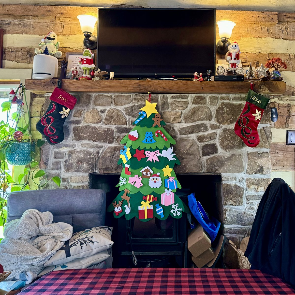
The fireplace at Christmas, November 2023. Photo courtesy of Michael Oak.
Sources for this section
- Real-estate listing photographs of the cabin, July 2015 and March 2019; each photograph’s credit names its source
- Photographs of the cabin taken by Michael Oak, 2019–2023, dated from their camera records
- Close-up photographs of the cabin’s construction, supplied by Michael Oak; date not recorded
- National Park Service, Preservation Brief 26: The Preservation and Repair of Historic Log Buildings
Look at the records
Five records carry much of this story. Each entry gives the record’s date, a citation and the way to reach the original.
-
June 6, 1872
The sale notice that names an overseer’s house
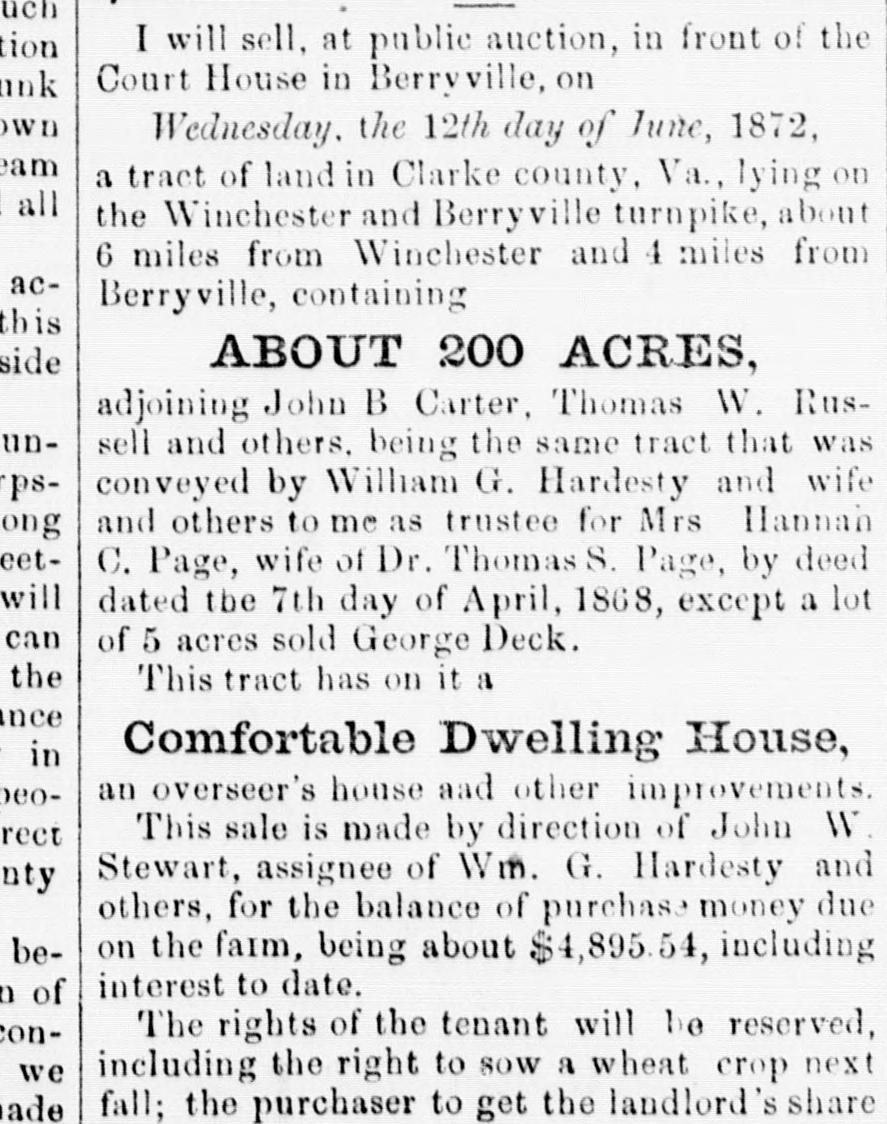
The 1872 sale notice lists an overseer’s house among the farm’s improvements. It does not locate that building. Detail of the Library of Congress page scan, unaltered. Clarke Courier (Berryville, Va.), June 6, 1872, page 3. Library of Congress, Chronicling America. The Clarke Courier’s notice offers the Hardesty home tract with “a Comfortable Dwelling House, an overseer’s house and other improvements.” It does not say where the overseer’s house stood or what it was built of.
Clarke Courier, June 6, 1872, page 3.
View the full page Library of Congress; free, no sign-in.
-
February 7, 1899
The deed to Charles E. Clevenger
The court-sale deed conveys 233½ acres to Clevenger. Its recital traces the land from the Hardesty estate through the Page trust and the Stewarts; it describes the buildings only as “all its buildings and appurtenances.”
Clarke County Deed Book Y, pages 458–460; recorded April 1, 1899.
View the deed image FamilySearch.
-
March 25, 1948
Visitors by Piper Cub
The Courier’s note that Mr. and Mrs. James Sunderlin flew in from Clinton, Maryland, and landed in a field at Rock Hall Farm to visit Glen and Leslie Sunderlin.
Clarke Courier, March 25, 1948, page 6.
View the full page Library of Congress; free, no sign-in.
-
April 17, 1972
An aerial photograph of the farm
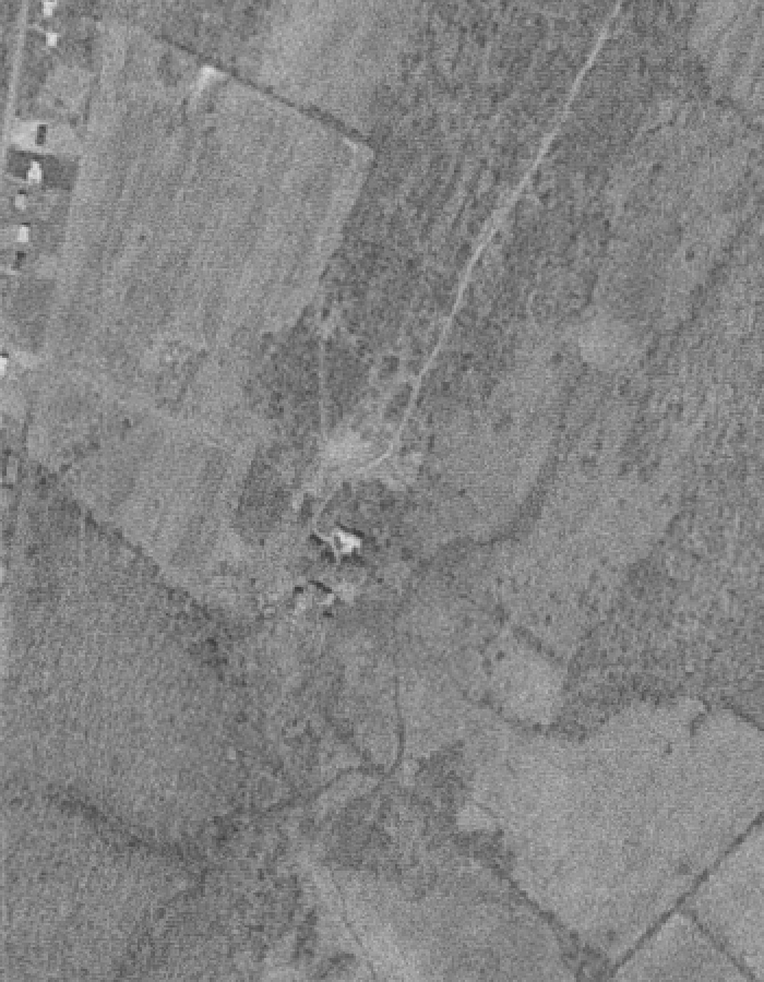
The Rock Hall farmstead on April 17, 1972. This grainy aerial is one part of the evidence used to identify the cabin’s site. Turned so north is roughly at the top, cropped and enlarged with nearest-neighbour resampling; no sharpening or marker. U.S. Geological Survey, Earth Resources Observation and Science (EROS) Center, Aerial Photo Single Frames, frame 1VCZM00050005, April 17, 1972. At the end of the cabin’s driveway, as the present owner identifies it, a small feature is consistent with a building; the photograph is too grainy to show a roof clearly. A second frame, from March 1977, is described in the source notes.
U.S. Geological Survey, Aerial Photo Single Frames, frame 1VCZM00050005, April 17, 1972.
Search USGS EarthExplorer Search Aerial Photo Single Frames for the frame number.
-
Dated December 18, 1987; revised August 1, 1994; recorded August 22, 1994
A survey of the farm, dated 1987
The legible lettering beside a small square reads “2 story” and “log”; a following word and a third line are illegible in the copy examined. The present owner identifies it as the cabin, and a T-shaped building as the farmhouse, and regards the survey as confirmation that the cabin was there in 1987. The copy examined is the survey as revised and recorded in 1994; it has not been compared with the original 1987 sheet.
Survey dated December 18, 1987; revised August 1, 1994; recorded August 22, 1994, Clarke County Deed Book 246, page 348; survey by Louis J. Matacia, L.S.
Not linked. The recorded survey is in the land records of the Clarke County Circuit Court clerk.
Sources and open questions
Questions still open
When the cabin was first built, how its uses changed, and whether the remembered relocation occurred. Its identification with the overseer’s house named in 1872 remains an interpretation, not a located building record.
Whether the original 1987 sheet of the farm survey, not yet examined, draws the building as the 1994 revised copy does.
Who was sold under the 1859 order, who bought them and what became of them, and whether Warner, Easter, Lewis, John, Sarah, Frances and Charles, named in 1848, were among them.
Whether the 1859 auction produced a sale and whether a complete title chain confirms the estate’s stone dwelling as today’s farmhouse; and whether C. W. Hardesty of the estate papers is the Charles W. Hardesty of the 1935 obituary. The circuit court’s chancery order book for 1858–1860, on Library of Virginia microfilm, has not been examined.
Where the Rock Hall of Jesse Russell’s account stood.
Whether a deed confirms the probable identification of the Clevenger farm of 1932–1933 with this Rock Hall, the succession after Charles E. Clevenger’s 1899 purchase, and when and from whom the Kimballs acquired it.
How the farm passed from the Kimballs to later owners, confirmed from the deeds themselves, and what Alltran, Inc. was.
The Clevenger farm 1932–1933
The five Courier notices cited in this section were checked against their page images during the research. The January 5 notice continues in another column: the held text stops before the words placing the couple at their home on the Clevenger farm, which were recovered from the image.
The identification rests on the combination of the Rock Hall name, the Clevenger farm name and the Winchester Pike location about four miles west of Berryville, consistent with later descriptions of the Kimballs’ home. Other properties carried the Rock Hall or Clevenger names; no deed has yet been read to confirm this connection.
The February 1932 advertisement calls the property “the farm of Miss Bertha Clevenger”; that is the newspaper’s description, not a verified ownership instrument. It advertises a sale of Fishpaw’s stock and implements, not a sale of the farm, and does not establish that the auction occurred. The January and October notices establish reported residences at two points, not a continuous January–October tenancy or a move date. No family relationship to the earlier Hardesty estate is asserted.
The farmhouse and the historic survey 1840–1989
The year built, 1840, is the county assessment record’s figure; it has not been checked against a deed or a dated building record.
The 1989 survey lists Rock Hall Farm, 21-281, among the vernacular stone buildings (report PDF page 24). It lists the house under its 1830–1860 heading and again among the farms of 1865–1914, a list it says includes older farms rehabilitated in that period, and it says earlier houses appear under the 1830–1860 heading only if substantially changed then. Its period headings classify buildings; they do not date their construction.
The Russell House, 21-285, is a separate entry (report PDF page 19); the state’s database also gives it the historic name Rock Hall Farm, but the two are not merged here.
The cabin 1872–2002
The June 6, 1872 Courier notice was read from its page image. It names an overseer’s house on the home tract but gives no location, material, dimensions, original date or occupant. The identification with the present cabin draws on that second dwelling, the later mapped building near this site, subsequent imagery and the standing log building. The essential inference is that the 1872 house stood here. Neither housing for enslaved people nor a particular cabin occupant has been established.
The 1938, 1942 and 1965 map editions repeat the 1937–38 USGS survey and count as one source, not three. Its secondary-building symbol is about 20–23 metres west-southwest of the present cabin when measured relative to the farmhouse; that comparison reduces shared positioning error but does not eliminate local distortion or symbol displacement. The 1958 aerial shows a light patch and track, not a clearly resolved roof. The 1964 and 1982 aerials are inconclusive, and a missing symbol in the 1973 map does not establish an empty site. Later maps based on 1977 photography mark a building, and the 1997 aerial shows a roof. Historic Aerials’ comparison snapshots were examined but are not reproduced here.
The actual 1972 and 1977 aerial scans were downloaded from USGS EarthExplorer and inspected in September 2026: frames 1VCZM00050005 and 1VEHO00010066. The farm was located using Route 7, Moose Road, the field boundaries and the main-house group. The present owner identified the cabin’s driveway and its endpoint in both photographs. Small features at that location are consistent with a structure; their graininess prevents a crisp roof identification. The statement that the photographs appear to show the cabin is a combined visual and site-based interpretation, not a precise surveyed identification or proof of the age of its logs. The two photographs are separate sources; multiple readings of either are not.
The 1972 frame is dated April 17, 1972. EarthExplorer lists the 1977 frame as March 22, but its film edge appears to read “3-2-77”; the exact March date remains unresolved. The comparison used unsharpened crops of the original scans, with no AI-generated detail. No new aerial images are reproduced on this page.
The cabin’s remembered retreat use and the separate West Virginia relocation story come from prior owners and neighbors, reported by the present owner. The description of an original historic cabin believed to date to the mid-1800s reflects the owner’s assessment of the hand-hewn log building; it is an estimated age, not a documented construction date or a scientific dating of the logs. “Original” describes the historic cabin, not a claim that every component remains unchanged. Its renovations and modern systems do not have a complete dated construction history. The cabin recollections are distinct from the oral history of the farm as a lawyer’s retreat. The relocation remains undated and unverified; continuity at the site is the working interpretation, not proof that no move ever occurred.
The farm survey is a boundary survey by Louis J. Matacia, L.S., dated December 18, 1987; revised August 1, 1994; recorded August 22, 1994, Clarke County Deed Book 246, page 348. The copy examined is a clerk’s printout of the recorded, revised survey, kept in a county environmental-health file; the original 1987 sheet has not been compared with it. The building’s legible lettering reads “2 story” and “log”; a word after “log” and a third line are illegible. The survey does not name the building. The present owner identifies it as the cabin, and the T-shaped building as the farmhouse, and regards the survey as confirmation that the cabin was there in 1987. “2 story” is the surveyor’s description; the county records one and a half stories. The survey dates neither the logs nor any move, and it is not reproduced here.
The Madisons’ application, signed November 18, 1995, calls the building existing. A December 29 letter explicitly describes a proposed renovation for living room, study, kitchen and bathroom use. The February 5, 1996 permit concerns sewage, not the cabin’s structure. These records do not date the foundation, first electrical connection or completed structural modernization. A Health Department letter of May 7, 2002 on the proposed subdivision refers to “the existing cabin on the proposed Lot 3.” Private county files are not linked or reproduced here.
The county’s current assessment card gives 1996 as the year built for each part of the cabin: the log section, the porch and the patio. The same system repeats 1840 on every part of the farmhouse, including a modern garage. What 1996 originally recorded is unknown. The assessment year of 1996 is not evidence of original construction or relocation, or that the cabin was renovated that year.
The state’s 1987–89 architectural survey photographed the farmhouse. Its public database entry lists a barn and a shed as outbuildings. The full survey form has not been examined, and the database entry does not show whether the surveyor saw the cabin.
The Hardesty family account 1858–1935
The Hardesty homestead is identified with this farm in a family account shared with the project in September 2026, accompanied by a family tree tracing the contributor’s descent from William Mason Hardesty (1858–1935). The 1935 obituary is the Courier notice of October 17, 1935, cited in the Hardesty chapter.
The Hardesty estate papers 1843–1886
Library of Virginia, Chancery Records Index, Clarke County cause 043-1886-025, read from its 88 page images: the clerk’s copy of the 1843 will (images 23–24), the decree of May 13, 1859 (images 18–19), the 1860 rent bonds (image 29), Adrian D. Hardesty’s sworn bill of September 26, 1865 and the injunction that followed (images 5–6), the heirs’ bill filed in July 1866 (images 2–4) and Adrian’s deposition of 1872 (image 21). The 1886 in the case number is the year the dormant case was struck from the docket (image 86); it is not the date of any of these papers. The file holds no report of either sale. No newspaper notice of the sale of the people has turned up in the digitized Winchester papers searched.
The 1848 inventory is known only from Duncan’s abstract; it is not in the case file. Duncan’s index lists the 1843 will under “Hardesty, Richard Sr.” and the inventory under “Hardesty, Richard”; reading them as one estate rests on the matching name and on the inventory’s court order of February 28, 1848, the same day the will came before the court; the inventory abstract itself names only its appraisers. Nothing in the papers names anyone who was sold or connects the people listed in 1848 with those sold after 1859. The $881.35 share covers the enslaved people and all the other personal property together; it is not a price for the people.
The 1859 notice put the land “four and a fourth miles from Berryville” and set the auction for noon on Thursday, November 10, on the premises. In 1860 John P. and Peter McMurray and a third man gave a bond of $502 “for the rent of a farm belonging to the estate,” and John Ritter a bond of $350 for farm rent. Adrian D. Hardesty testified that “Charles Hardesty got 33 bus. of wheat at the same time” as his own seventy. The heirs’ 1866 bill adds that, as they had been advised, a commissioner found $881.35 due to each child “for & on a/c of sales of slaves & all other personalty together.” Adrian had been one of the guarantors of William’s bond as commissioner. In September 1865 he swore that William was offering the land at private sale by an advertisement signed in his own name, not as commissioner; the judge’s injunction forbade William to sell it in any way except as the 1859 order directed, and an order at the October term ended it.
The October 7, 1859 notice and the September 26, 1866 notice were checked against the page images. The 1859 notice ran weekly through November 4; those later printings were read from the digitized text only. Each figure on this page belongs to its own notice. The two notices give different acreages and distances for the farms, and only the 1866 notice counts the stone dwelling’s rooms; an undated advertisement filed in the case, which gives other figures again, is not used here. The differences are unexplained. The notices describe the Hardesty farms but do not name Rock Hall, and no deed yet connects them with the present farmhouse; the family account is the basis for placing the homestead here.
The 1939 historical society list was read from the digitized text of the June 22, 1939 Courier. It names a Rock Hall in Longmarsh District as the Hardestys’ but does not locate it, and the list called itself tentative.
The later home-tract conveyances are documented separately in Clarke chancery cause 043-1879-002, images 6–8 and deed exhibit 92, checked against the page images during the research. The case identifies the Hardesty Home farm, conveyed to S. J. C. Moore as trustee for Hannah C. Page on April 7, 1868 (Deed Book H, page 342), and sold to John W. Stewart on June 12, 1872. The 1872 notice matches the trustee, deed date, beneficiary and five-acre exception for George Deck. The resulting tract was 199 acres, 3 roods and 17 poles; those five acres must not be subtracted again. This places the overseer’s-house notice on the home tract but does not locate that building within it.
A possible earlier Hardesty purchase 1815–1832
An 1815 deed records Richard Hardesty, then of Jefferson County, buying 201¼ acres in Frederick County from Thomas and Mary Neil of Alexandria. The tract began in “the great road leading from Winchester to Battle Town,” and the deed was recorded on July 31, 1815. This may be an earlier acquisition of the later Rock Hall property, but the tract connection is not established: the deed names no adjoining owner or stream, and no later record read so far refers back to it.
In 1832 Hardesty bought 48 acres 3 roods 9 poles adjoining land he already owned. That parcel, too, is not linked to Rock Hall. Neither deed describes a building. Both were read from the page images; the volume numbers of the two deed books were not seen on the pages read.
Frederick County deed of April 1, 1815, pages 233–236 (FamilySearch image of pages 234–235)
Frederick County deed of August 27, 1832, pages 238–239 (FamilySearch)
The Stewart interests and the 1899 Clevenger purchase 1872–1899
The June 12, 1872 deed is Clarke Deed Book K, pages 245–246. John William Stewart’s will, dated August 5, 1876 and proved September 29, is in Berkeley County, West Virginia, Will Book 23, pages 38–42. Both were checked against their page images. The will describes the home tract and an adjoining Bard parcel of between thirty and forty acres. The later court bill states the Bard parcel as thirty-three acres. These are source-specific descriptions, not an exact modern survey.
The Clevenger deed is Clarke Deed Book Y, pages 458–460, dated February 7, 1899 and recorded April 1; an April 3 marginal note concerns delivery. Its tract identity rests on the prior-title recital, not merely the Clevenger name. The purchase is distinct from the unresolved later succession to Bertha and the Kimballs.
Clarke chancery cause 043-1899-011 contains the court-sale papers. All sixty-four images were inventoried and sixteen were closely read, some in part. The February 3, 1896 decree calls the land 230 acres; the later deed conveys 233½. The February 10, 1899 decree confirms the private bid subject to Robert H. Stewart’s heirs joining the conveyance. The commissioner’s receipts total $6,187.75, equal to 233½ acres at $26.50. The deed’s February 7 date and the decree’s February 10 date are retained separately.
Carlisle’s tenancy and Rutherford’s recollection of Payne come from the January 1896 depositions, images 39–41. Brotherton’s growing-crop reservation is in image 26. None locates an occupant in the cabin. The catalog and the packet overview disclosed no plat, and the closely read testimony mentions buildings without describing them.
The inherited and separately purchased interests followed different routes. The 1878 sheriff’s deed conveys a one-tenth interest, while the 1899 deed calls Robert’s purchased interest one fifth and also recites an unexamined R. T. Barton conveyance. That difference remains unresolved. The court’s later distribution was not six unchanged equal holdings, and the ages stated for the original beneficiaries should not be presented as their ages at the later filing.
Clarke County chancery cause 043-1899-011
Clevenger deed, pages 458–459
Recording certificate, page 460
Juliet’s family: a freedom clause and later records 1839–1857
Patricia B. Duncan, Clarke County, Virginia Will Book Abstracts (Heritage Books), printed page 183: the 1839 will (1A:013), the 1842 agreement (1A:079) and the 1848 inventory (1A:015). These readings come from the printed abstracts, not from the original will books.
The sale in 1857 is reported in Jesse Russell’s later account. The estate accounting abstract of that year (1A:088) describes hire income, payments and a balance; it names no purchasers and does not identify sale proceeds.
The Clarke Courier 1935–1963
The March 18, 1948 notice (page 9), checked against the page image, describes General Neill Kimball “of Washington” spending the weekend with Mrs. Kimball at Rock Hall Farm, “their home in Clarke.” The March 25 issue (page 6), also image-checked, identifies his Veterans of Foreign Wars public-relations post. The notice documents one Washington-to-country-home visit; its issue date is not the date of the visit. It establishes no move date, motive, regular commuting schedule or connection to the later lawyer.
Notices through 1948 were read from the Library of Congress’s digitized pages; the 1950–1963 notices from Virginia Chronicle, whose online run of the Courier ends in 1963. The May 23, 1963 issue announced General Kimball’s address for Sunday, May 26; the May 30 issue reported that he spoke on Sunday and printed the words quoted here. The quotation and the announcement’s date line were checked against the page images. The quotation begins within a longer sentence, with its first word capitalized for display, and retains the speaker’s explanation of whom he meant by “the living.”
The Fine Arts report (March 22, 1962), the painting awards (March 21, 1963), the January 19, 1950 notice of Anne Hafen’s research and the November 8, 1962 poetry notice were checked against the page images; the Courier prints her name as Anne and the book’s subject as “Meriweather Lewis.” The other Hafen visits (1948, 1955, 1957, 1960) are read from the digitized text. The notices place the Hafens’ research in Washington and elsewhere, not at the farm.
The 1963 picnic names the Sunderlins as co-hosts, not necessarily residents that year. The February 27, 1958 notice names Mrs. Glen Sunderlin as General Kimball’s sister. The Courier spells the general’s name Neil, Niel and Neill; the narration follows the 1952 deeds, which also give Mrs. Kimball’s name as Jean.
The census of 1950 writes the Sunderlins’ name as Sunderland; it does not name the farm, and places the Kimball household on a farm in rural Long Marsh district. The December 2, 1948 notice announced the door-decoration demonstration; no report that it took place was found.
The Kimballs’ Colorado family 1866–1959
The West family connection comes from the Golden History Museum & Park catalog, whose c. 1905 photograph of George and Eliza West is inscribed with their grandchildren “Neil West Kimball” and “Leslie Kimball,” and which catalogs Leslie under the married name Sunderlin; and from Colorado Community Media’s 2021 history of the Transcript, which dates George West’s paper to 1866. The museum’s photographs are not reproduced here.
The Kimballs’ July 1958 letter 1958
The letter of July 17, 1958, signed “Jean and Neil” and addressed to the Goetzes, was read from the museum’s digitized images of both sides of the sheet. It is part of Golden History Museum & Park’s Letters written to Irene Goetze, FIC2025.32. The images are not reproduced here.
The letter does not name Rock Hall as its place of writing. That identification is an interpretation, resting chiefly on the February 1958 Courier notice of the Kimballs reopening their home after New Mexico and the letter’s reference to their long trip the previous winter. Its distance to Leslie and Glen is the writers’ description, not a mapped address. The herdsman’s dairy experience is stated; the letter is not quoted as explicitly identifying a dairy herd. The opening capital in “We both miss” begins an excerpt from a longer sentence.
Golden History Museum & Park, Letters written to Irene Goetze, FIC2025.32
County land records 1952–2005
The 1952 conveyances to Herman Sisk (Deed Book 42, page 263) and Eddie Sisk (page 265) were read from copies in a county environmental-health file; page 264 is not in the file. They name Jean E. Kimball as Neill’s wife.
The 1962 map is known from the Courier’s notice of June 21, 1962; the notice date is not necessarily the date the map was approved or recorded, and the original plat has not been examined. The 1999 and 2004 sales are from the county’s real estate record for 420, which lists sellers only. The 2003 subdivision approval (Deed Book 380, page 139) and the 2005 sale of the cabin lot come from county files that are not linked from this page, and the original 2003 plat has not been examined.
The 1963 lot and the Kimballs’ surrounding land come from the recorded survey at Deed Book 69, page 116 and the recital in Deed Book 70, page 476. Alltran’s ownership by 1974 comes from the neighboring survey at Deed Book 105, page 285. The 1972 and 1988 conveyances (Deed Book 97, page 119; Deed Book 183, page 661) are known only from county staff notes and survey references, and neither deed has been read. This is a supported working chronology, not a verified chain of title; a company’s ownership does not show who lived on the farm. The farm survey at Deed Book 246, page 348 was examined only in its 1994 revised and recorded form. The 1994 granting page (page 344), the 1999 deed (Deed Book 308, page 189) and the missing 1952 page (Deed Book 42, page 264) were not found through the routes tested. The copies were seen in county environmental-health files and are cited without a link.
Frank B. Hand Jr. 1965–1987
The 1987 county file gives the owner as Alltran, Inc., with Frank B. Hand Jr. as its agent; one form in it enters Hand himself as owner. It does not say what Alltran was or what part Hand had in it.
The memory of the farm as a Washington lawyer’s country retreat is oral history. Frank B. Hand Jr. is a plausible candidate for that lawyer, not an established identification. This interpretation concerns use of the farm; it does not identify Hand as the person who commissioned or moved the cabin.
The identification of that agent with the 1978 representative and the art donor rests on the matching name; the Berryville mailing address in the 1978 Federal Register notice; the National Gallery’s provenance, which gives the donor’s dates as 1914–1992 and his homes as Herndon and Washington; GW Magazine’s description of the donor as a graduate of the university’s college and law school; and college newspaper notices of 1977, read from digitized text only, that call a Frank B. Hand both a Berryville lawyer and a Herndon resident. No single record names the donor as the farm’s owner, and nothing found connects him with the cabin.
“Norton Wins,” a 1916 oil, went to the Corcoran Gallery of Art and is now in the National Gallery of Art. George Washington University’s magazine later remembered the donor as “a frequenter of Greenwich Village art galleries.” In 1978 a Frank B. Hand Jr., listing a Berryville mailing address, was the representative on a motor carrier’s application to federal regulators.
Have a correction or a source for this account? Help fill a gap. It stays private until it is reviewed.
Have a memory of Rock Hall Farm or the surrounding area? Share a memory, even if you do not know the date. It stays private until it is reviewed.